Madrid · Self-guided audio walk

The King's Park and the Banker's Grid

From a royal lake where kings staged naval battles to the 19th-century grid built for Madrid's new money.

  • 7Stops
  • 4.3 kmDistance
  • 60+ minTime

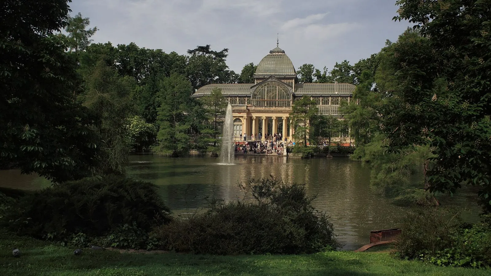
This walk pairs the park that was the king's private retreat with the grid that was Madrid's leap outward. You start at the Puerta de Alcalá, the neoclassical gate Carlos III commissioned in 1778. Cross into El Retiro, public only since 1868, and walk to the great artificial lake dug in the 1630s for mock naval battles staged for the court. The Palacio de Cristal, a glass-and-iron greenhouse from 1887, sits on its own reflecting pond, and the Palacio de Velázquez nearby opened in 1883 as the first of the Retiro's exhibition halls.

Then you leave the park to the north for Salamanca, the grid the Marqués de Salamanca laid out after 1860: wide streets, uniform balconies, running water, and the first private toilets in Madrid. Calle Serrano runs north as its shopping spine, and the Mercado de la Paz has sold hake and olives to the neighborhood since 1882. You end at Plaza de Colón, where the orderly grid meets the older city.

Hear it on the street

Get the turn-by-turn audio guide in the app. The narration plays itself as you reach each stop, hands-free and offline.

Stop by stop

The route

Interactive map of the route. The full stop list below works without it.

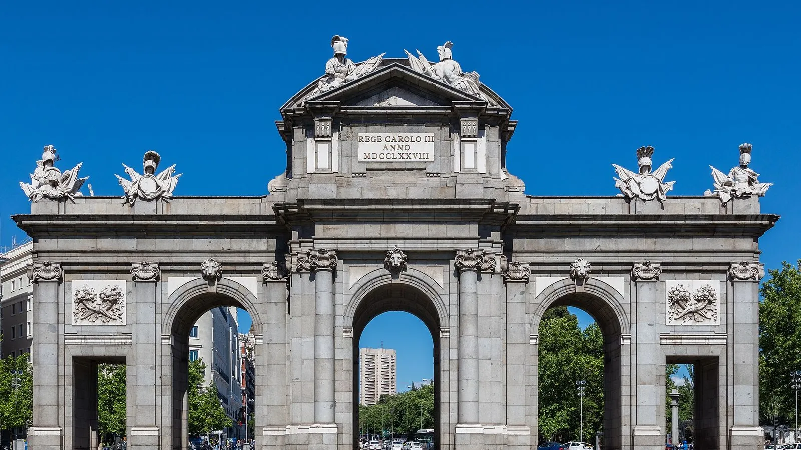
Puerta de AlcaláMust see

Photo by Diego Delso on Wikimedia Commons

Puerta de Alcalá

0:00

The neoclassical gate Carlos III commissioned in 1778, marking where old Madrid ended and the countryside began.

You're standing in front of the Puerta de Alcalá, the neoclassical gate King Carlos III had built in 1778. It was designed by Francesco Sabatini, the same architect who worked on the Royal Palace. The gate is almost twenty meters high and forty-three meters wide, built from white Colmenar stone with details in Segovian granite. It has five arches: three tall ones for carriages, two smaller side arches for pedestrians.

Before the city expanded, this was the eastern edge of Madrid. Everything beyond it was open countryside. The gate didn't defend anything. It was a statement: Madrid was no longer a cramped medieval town but a capital that deserved a proper monumental entrance.

Walk through the central arch now and cross into what was once the king's private retreat.
≈9 min walk to the next stop
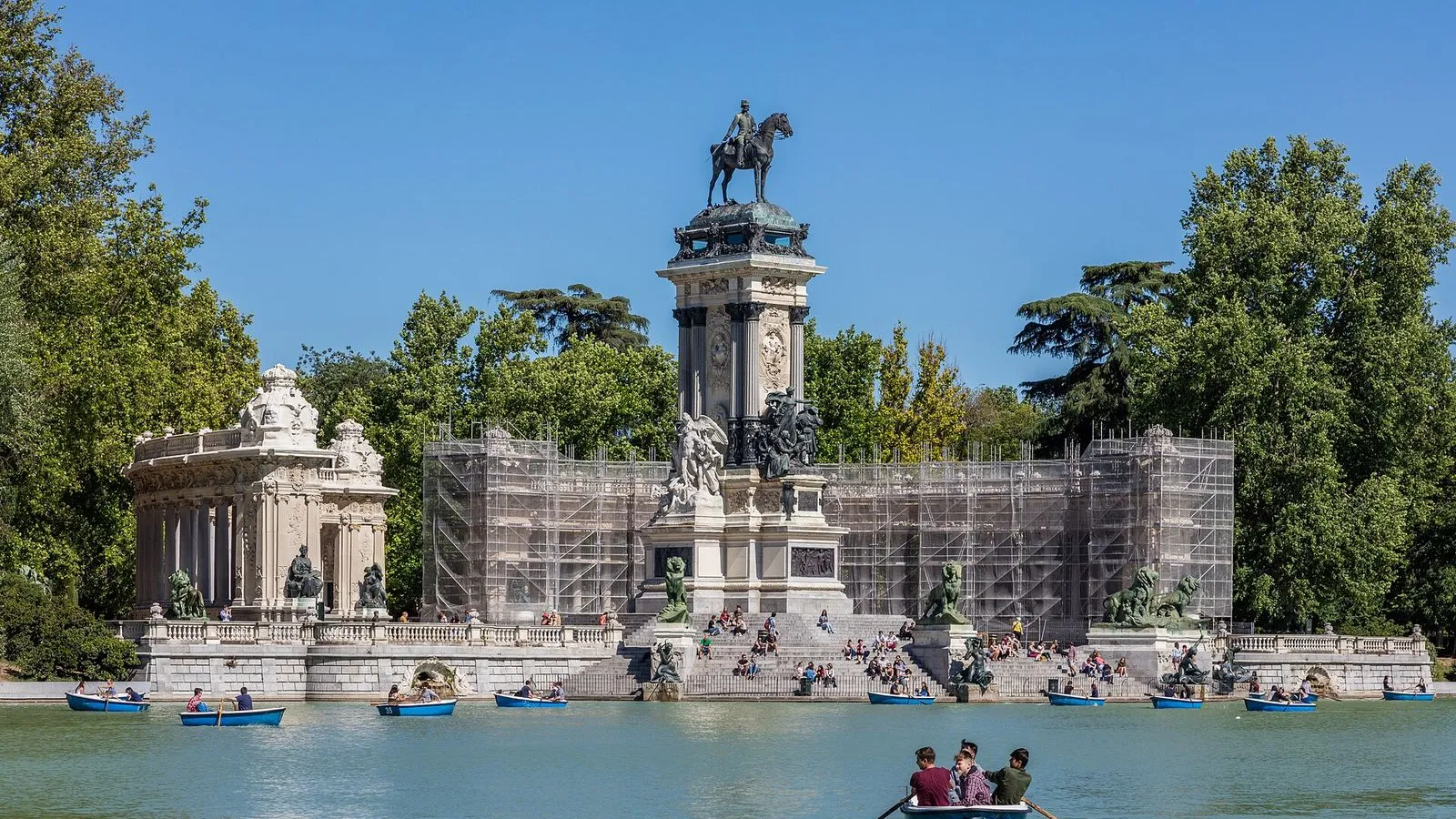
Estanque del RetiroMust see

Photo by Diego Delso on Wikimedia Commons

Estanque del Retiro

0:00

The great artificial lake dug in the 1630s for court naval battles, now a rowboat pond beneath Alfonso XII's colonnade.

You've reached the Estanque Grande, the large artificial lake at the heart of the Retiro. It was dug between 1634 and 1636 by the architect Cristóbal de Aguilera. Philip IV used it to stage naumaquias, mock naval battles with real ships, for the entertainment of the court. An oval island once sat in the middle where actors performed plays and musicians gave concerts.

Farinelli, the great castrato singer, performed for Philip V from that island. By the late eighteenth century the island was submerged, and in 1902 Madrid erected the monument you see now. The semicircular colonnade with the equestrian statue of Alfonso XII was paid for by popular subscription, designed by José Grases Riera, with the horse and rider sculpted by Mariano Benlliure. On a Sunday morning you'll see rowboats full of families exactly where galleons once fired cannons for a king.

When you're ready, keep the water on your right and follow the path south toward the glass building ahead.

≈7 min walk to the next stop
Palacio de CristalMust see

Photo by Javier Perez Montes on Wikimedia Commons

Palacio de Cristal

0:00

A glass-and-iron greenhouse from 1887, built for a Philippine exhibition, floating on its own reflecting pond.

The Palacio de Cristal. It was built in 1887 for the General Exhibition of the Philippines, a showcase of plants, crafts, and people from Spain's Pacific colony. Ricardo Velázquez Bosco designed it, drawing heavily from Joseph Paxton's Crystal Palace in London. The iron frame was cast in Bilbao and the whole structure went up in just five months thanks to prefabricated modules.

It's laid out as a Greek cross, capped with a glass dome twenty-four meters high. The building was meant to be temporary and transportable, like the London original, but it never moved. It sits on a brick base decorated with ceramic friezes by the Zuloaga brothers, and the artificial pond in front doubles the whole scene on a still day. Inside there's no permanent collection.

It's an exhibition space run by the Reina Sofía museum, and the art changes, but the light pouring through the glass is the real show.

≈3 min walk to the next stop
Free preview ends here · stops 4 to 7 continue in the app

Palacio de Velázquez

The 1883 exhibition hall that preceded the Crystal Palace, now another Reina Sofía gallery of contemporary art.

in app

Calle Serrano

The posh shopping spine of the Salamanca district, a wide boulevard of uniform balconies and luxury boutiques.

in app

Mercado de la Paz

A neighborhood market open since 1882, still selling hake and olives to the locals in an iron-and-glass hall.

in app

Plaza de Colón

The hinge where the Salamanca grid meets the old city, with the Columbus monument and the Jardines del Descubrimiento.

in app
Good to know

Before you go

Is the Retiro Park free to enter?

Yes. El Retiro has been a public park since 1868. The only thing you pay for is a rowboat on the lake (about €6 for 45 minutes). The Palacio de Cristal and Palacio de Velázquez are both free and house contemporary art exhibitions.

What is the Salamanca district like?

Salamanca is Madrid's most affluent neighborhood, laid out on a grid after 1860 by the Marqués de Salamanca with wide streets, uniform balconies, and the city's first private toilets. Calle Serrano is the luxury shopping spine. The Mercado de la Paz, open since 1882, is the neighborhood's soul: a working market where locals still buy hake and olives.

Keep exploring

More walks in Madrid

Provenance · last verified August 21, 2026

Built from the Wayside route itself: the stops, their order, and the walk between them.

Photo by Jose Luis Cernadas Iglesias from Coruña, España on Wikimedia Commons · CC BY 2.0

Photo by Diego Delso on Wikimedia Commons · CC BY-SA 4.0

Photo by Diego Delso on Wikimedia Commons · CC BY-SA 4.0

Photo by Javier Perez Montes on Wikimedia Commons · CC BY-SA 4.0

Photo by Nicolas Vigier on Wikimedia Commons · CC0

Photo by Tim Tregenza on Wikimedia Commons · CC BY-SA 3.0

Photo by Felipe Gabaldón on Wikimedia Commons · CC BY 2.0

Photo by Tinou Bao on Wikimedia Commons · CC BY 2.0

Photo by Jorge Láscar on Wikimedia Commons · CC BY-SA 2.0

Photo by FEDERICO JORDÁ from MADRID, ESPAÑA on Wikimedia Commons · CC BY 2.0

Photo by Nicolas Vigier from Madrid, Spain on Wikimedia Commons · CC0

Coming soon

Wayside isn't in the app stores yet, but it's in the works. Check back soon.