Self-guided walking tours in New York City
8 walking toursNew York, United States

Photo by Danny Best on Unsplash
New York City was made for walking. Twelve numbered avenues slice through Manhattan's grid, and between them, 200-some streets each have their own rhythm. On foot you catch the shift from the financial district's stone canyons to the Village's crooked lanes and SoHo's cast-iron facades, then up through Midtown's towers to the green expanse of Central Park. The real city lives at sidewalk level.
- ItineraryOne day in New York CityDutch cobblestones at dawn, the Brooklyn Bridge at noon, the neon grid at dusk, and the elms of Central Park after dark: four centuries of New York, one day, on foot.
- Know before you goNew York City practicalitiesWhat to know before you land: airport math, the OMNY tap that caps your subway week at $35, hotel taxes that add 15% to the bill, and why the tap water is safer than bottled.
Tours in New York City
 The essentials
Midtown: The City in the Sky
From Grand Central's stars to Central Park's canopy: the classic Midtown walk that delivers every New York postcard moment in one afternoon.
 The essentials
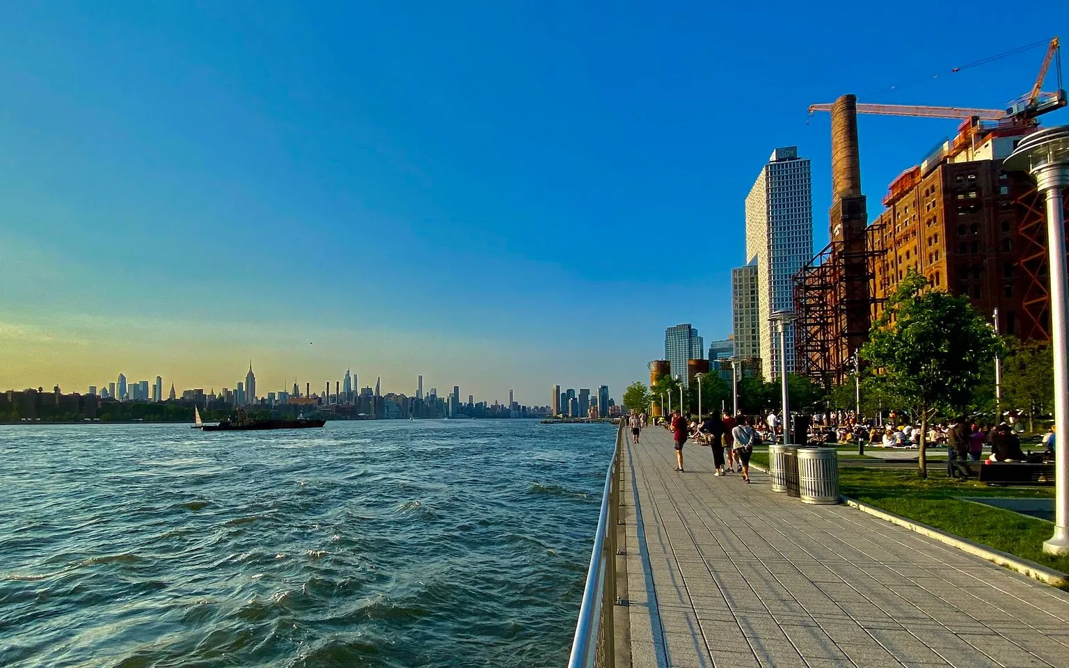
Williamsburg: Brooklyn's Creative Coast
Street art, sugar refineries, and the rebirth of a waterfront: walk the Brooklyn that reinvented itself.
 The essentials
Below the Grid: Downtown Villages Walk
From the East Village to the High Line, a walk through the crooked streets, cast-iron palaces, and countercultural corners the 1811 grid never tamed.
 The essentials
Harlem: Jazz, Gospel, and the Renaissance
Walk the streets that gave the world swing, soul, and the 20th century's great Black cultural awakening.
 The essentials
The Oldest Mile: Lower Manhattan from Battery to Brooklyn
Walk four centuries in an afternoon, from a Dutch fort to a cathedral of commerce, then cross the bridge that rewrote what a city could be.
 The essentials
Central Park: The Green Heart
843 acres of designed wilderness, from the elm canopy of the Mall to the quiet paths of the Ramble.
 The essentials
Chinatown & the Lower East Side: Immigrant New York
Walk the streets where seven million newcomers first set foot in America, from the Bloody Angle to the oldest deli on the Lower East Side.
 The local mix
Brooklyn Heights: Brownstones and the Waterfront
New York's first suburb, from hidden cobblestone mews to the Promenade where Manhattan hangs across the river like a backdrop.
What you'll see
67 stops mapped across 8 walking tours in New York City. A few of the places the routes take you past:
- Grand Central Terminal
- New York Public Library Main Branch
- Bryant Park
- Times Square
- Rockefeller Center
- St. Patrick's Cathedral
- The Pond
- Gapstow Bridge
- The Mall
- Bedford Avenue station
- ROA Squirrel Mural
- Faith47 Mural: Lay Your Weapons Down
Before you go
How long do I need to see New York City?
One day is enough to walk the essential skyline reel (Lower Manhattan, the Brooklyn Bridge, Midtown, and Central Park) if you start early and stay on your feet. Three days gives you time for a museum (the Met or MoMA), a neighborhood like the West Village or Harlem, and a Broadway show. A week lets you cross into Brooklyn and Queens, eat your way through Chinatown and the Lower East Side, and see the city at something closer to its own pace.
SourceNYC Itinerary GuideWhen is the best time of year to visit New York?
October is the best month: the light is low and gold, the trees in Central Park turn color, and the summer crowds have thinned. May and June are also strong, with mild temperatures and the parks in bloom. December has the holiday windows and the Rockefeller Center tree, but the sidewalks are packed. July and August are hot, humid, and crowded. January and February can be bitterly cold, but hotel prices drop and the museums are quiet.
SourceTravel LemmingIs New York City safe for tourists?
New York is the safest large city in the United States, and the neighborhoods on this itinerary (the Financial District, DUMBO, Midtown, and Central Park) are well lit and heavily trafficked from early morning until late at night. The subway runs 24 hours and is safe at all hours. Keep your phone out of your hand near the curb on busy intersections; phone snatches from passing cyclists are the most common street crime. Otherwise, walk with the confidence of someone who knows where they are going, even if you do not.
How do I get around New York City?
The subway is the fastest way to cross the city. Tap any contactless credit card or phone at the OMNY reader at the turnstile; a single ride is $2.90, and the fare cap is $34 for a 7-day period. Google Maps gives reliable subway directions. Buses are slower but above ground. Walking is the best way to understand the city's scale and rhythm, and most of the classic sights in Manhattan sit within a 30-minute walk of each other. Ride-share apps work everywhere but Midtown traffic often makes them slower than the train.
SourceMTADo I need cash in New York City?
Almost nowhere. Every major attraction, restaurant, and subway turnstile accepts contactless payment. Street vendors, fruit carts, and some older bodegas still prefer cash. Carry $40 in small bills as backup and you will be fine.
Can I see the Statue of Liberty for free?
The Staten Island Ferry runs from the Whitehall Terminal in Battery Park to Staten Island and back, 24 hours a day, and it costs nothing. The ferry passes within clear view of the Statue of Liberty and Ellis Island. The round trip takes about an hour. If you want to set foot on Liberty Island, you need a paid ferry ticket from Statue City Cruises, and you should book at least a week ahead in high season.
Is New York wheelchair accessible?
Most of Manhattan's sidewalks are wide and curb-cut. Many subway stations have elevators, but not all; check the MTA's accessible stations map before you go. The Brooklyn Bridge walkway has a smooth wooden ramp. Central Park's main paths are paved and flat. Major attractions (the 9/11 Memorial, the Oculus, Grand Central, Rockefeller Center, and the Public Library) are all step-free. Buses are fully accessible and often easier than the subway.

Walk New York City
Get the audio guide in the app.
Walk the city with a local in your ear: turn-by-turn stories, offline maps, and the confidence of someone who knows every block.
More cities in the United States
Provenance · last verified August 7, 2026
Built from the Wayside walking tours in this city and the stops they cover.
Photo by Danny Best on Unsplash
Photo by Andre Carrotflower on Wikimedia Commons · CC BY-SA 4.0
Photo by Customerly on Unsplash
Photo by Annie Spratt on Unsplash
Photo by Florian Wehde on Unsplash
Photo by Kazuma Sako on Unsplash
Photo by Famartin on Wikimedia Commons · CC BY-SA 4.0