London · Self-guided audio walk

Seven Dials to Denmark Street: Covent Garden & Soho

A late-afternoon walk through the West End's twin engines of pleasure, from a seven-street junction to London's guitar row, with the story of a water pump that changed medicine.

  • 8Stops
  • 2.6 kmDistance
  • 45+ minTime

This walk cuts through the West End's liveliest quarter, where Covent Garden's street performers and Soho's neon collide. You start at Seven Dials, a junction built by a 17th-century speculator to squeeze in more rent-paying frontages, then dip into Neal's Yard, a courtyard painted in colours that seem to belong to a warmer city. The Covent Garden Piazza gives you Inigo Jones's grand square and the actors' church of St Paul's. Across the invisible border into Soho, you pass through Chinatown's red lanterns to Broadwick Street, where in 1854 a doctor named John Snow traced a cholera outbreak to a single water pump and, by removing its handle, helped found modern epidemiology. The walk closes on Denmark Street, London's guitar row, where the Rolling Stones cut their first album and the Sex Pistols rehearsed in a basement.

Hear it on the street

Get the turn-by-turn audio guide in the app. The narration plays itself as you reach each stop, hands-free and offline.

Stop by stop

The route

Interactive map of the route. The full stop list below works without it.

Seven DialsMust see

Photo by N Chadwick on Wikimedia Commons

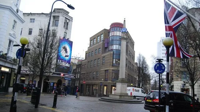
Seven Dials

0:00

A seven-street junction built in the 1690s by Thomas Neale to pack in as many rent-paying shopfronts as possible. The sundial pillar at the centre replaced the original in 1989.

You are standing at the centre of Seven Dials, where seven narrow streets shoot off in different directions like spokes. The man who built this junction in the 1690s was Thomas Neale, a speculator and MP who spotted a loophole. A street frontage paid more ground rent than a back garden. So instead of laying out a conventional grid, he drew seven streets radiating from a single point, each one lined with shops and houses that all counted as frontages.

He squeezed maybe twenty extra rent-paying plots out of the same acreage. The sundial pillar in front of you is a 1989 replica. The original had only six faces. Neale planned a seventh but never built it, and the pillar itself was torn down in 1773.

For the next two centuries this was one of London's most notorious slums, a warren so dangerous that constables refused to enter it alone. Today the boutiques and coffee shops give little hint of the rookery that Dickens wrote about. When you are ready, walk up Monmouth Street. In about three minutes you will see a narrow opening on your left, almost too easy to miss.
≈2 min walk to the next stop
Neal's YardLocal pick

Photo by Anthony Webb on Wikimedia Commons

Neal's Yard

0:00

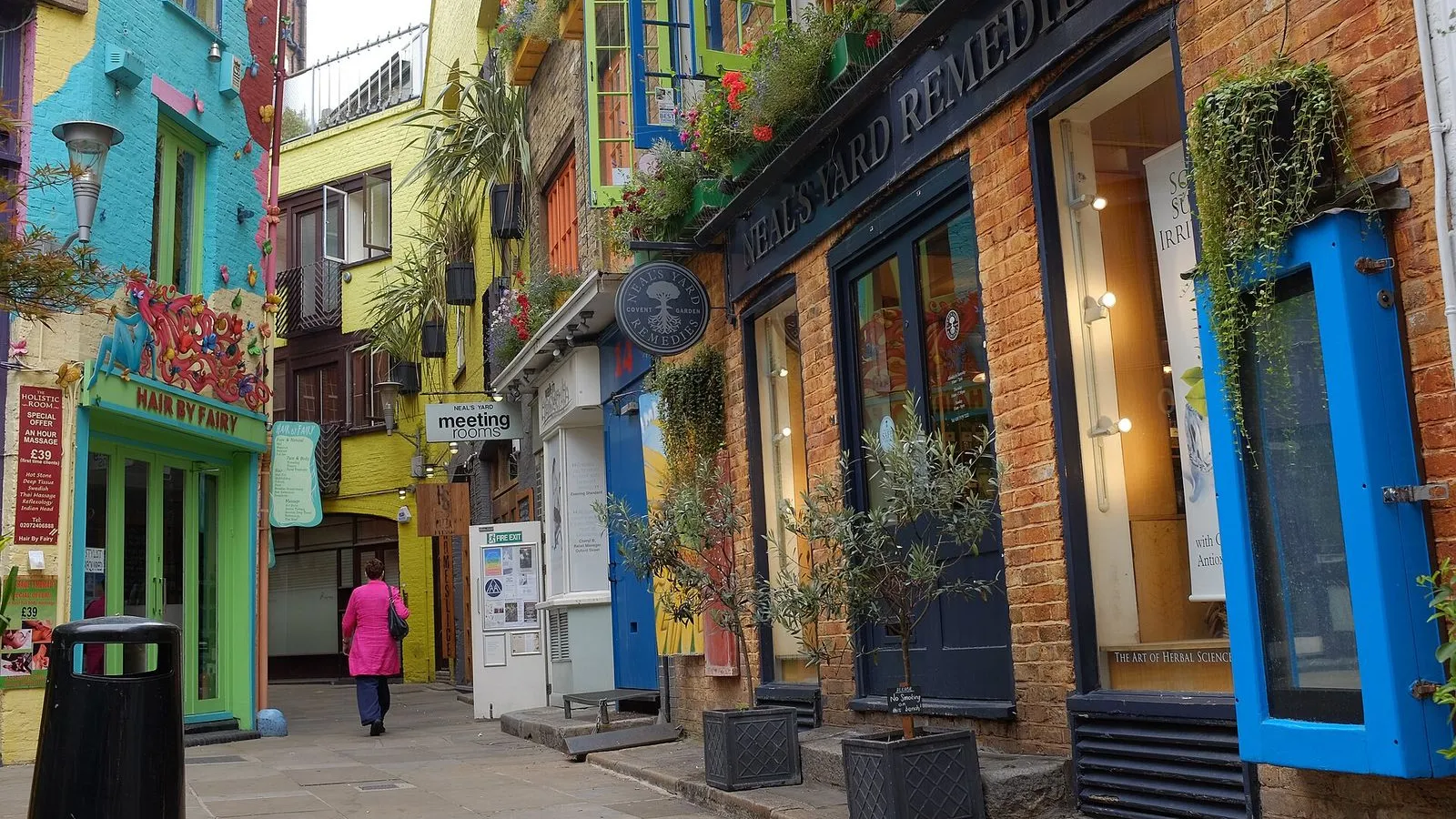
A pocket-sized courtyard painted in vivid blues, greens and yellows, rescued from dereliction in 1976 by the entrepreneur Nicholas Saunders and now home to independent cafés and shops.

This courtyard did not appear on the London A to Z until the late 1970s. Before that it was a filthy backyard, a collection of derelict warehouses serving the old Covent Garden fruit market, overrun by rats. In 1976 a restless entrepreneur named Nicholas Saunders bought one of the empty buildings for seven thousand pounds and opened the Whole Food Warehouse. The health food shop took off, and soon Saunders was encouraging other small businesses to move in.

He built the planters, painted the buildings bright colours, and created what he called a village community of independent traders. Neal's Yard Dairy, the cheese shop to your right, and Neal's Yard Remedies, the blue-fronted skincare shop, both grew out of this experiment and became names known far beyond this courtyard. Michael Palin and Terry Gilliam bought offices here too, drawn by the same scrappy energy. The Yard is small enough that you can see it all in a minute, but the benches and cafés invite you to sit.

When you are ready, exit through the same narrow passage onto Shorts Gardens, turn left, then right onto Neal Street and follow it south. The street opens onto Covent Garden in about four minutes.

≈6 min walk to the next stop
Covent Garden PiazzaMust see

Photo by Anders Hanson on Openverse

Covent Garden Piazza

0:00

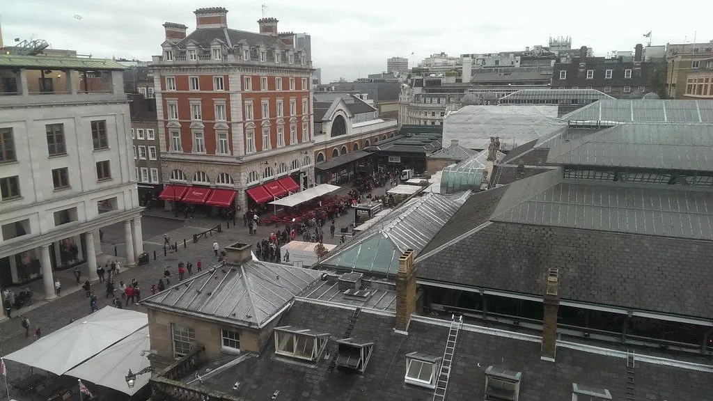
London's first planned square, laid out by Inigo Jones in the 1630s. The covered market halls now host shops and restaurants, and the piazza is a stage for street performers every afternoon.

You are standing in Covent Garden Piazza, but the name is misleading. Covent Garden was never a garden. It was a convent garden, the walled vegetable patch of Westminster Abbey, until Henry VIII seized it. In the 1630s the Earl of Bedford hired Inigo Jones, the architect who brought classical proportion to England, to design London's first planned square.

Jones gave the city something it had never seen: a regular open space lined with arcaded houses, modelled on the piazzas of Italy. On the west side stands St Paul's Church, and to your left the grand portico belongs to the Royal Opera House. But the piazza really found its life in 1670 when the Earl of Bedford secured a royal charter for a fruit and vegetable market. For three centuries this square was a working market, its cobbles slick with cabbage leaves before dawn.

The market moved out to Nine Elms in 1974, and after a campaign to save the buildings from demolition, the piazza reopened as the shopping and performance space you see now. The street performers who work the cobbles today are a direct line back to the 17th century, when this was one of the few places in London where you could legally busk. When you are ready, walk to the west side of the piazza, toward the church with the Tuscan columns.

≈2 min walk to the next stop
Free preview ends here · stops 4 to 8 continue in the app

St Paul's Covent Garden

Known as the actors' church, this 1633 Inigo Jones design faces the piazza with a severe Tuscan portico. Inside, memorial plaques honour performers from Charlie Chaplin to Vivien Leigh.

in app

Chinatown

Gerrard Street, hung with red lanterns between ornamental gates, is the heart of London's Chinatown. The area was home to French Huguenots before the Chinese community settled here in the 1950s.

in app

Broadwick Street

The site of the Broad Street water pump, where Dr John Snow traced a deadly cholera outbreak in 1854 and, by removing the pump handle, demonstrated that contaminated water, not bad air, spread the disease.

in app

Soho Square

A garden square laid out in the 1680s, with a half-timbered Tudor lodge at its centre. Once home to aristocrats, then to offices, the square now offers a green pause in the middle of Soho.

in app

Denmark Street

London's guitar row and former Tin Pan Alley, where music publishers gave way to recording studios and instrument shops. The Rolling Stones cut their first album at number four; the Sex Pistols rehearsed above number six.

in app
Good to know

Before you go

When is the best time to walk Covent Garden and Soho?

Late afternoon into early evening is ideal. Covent Garden's street performers are out from midday onward, but the piazza is at its liveliest between 15:00 and 18:00. Soho wakes up later. Denmark Street's guitar shops close around 18:00, so go earlier if you want to browse. Chinatown's restaurants and Soho's bars fill up after 19:00.

What is the Broadwick Street water pump story?

In 1854 a Soho cholera outbreak killed more than 600 people within a few blocks. A doctor named John Snow mapped the deaths, traced them to a single water pump on Broad Street, and persuaded the local council to remove its handle. The outbreak stopped. Snow's map became a founding document of epidemiology. A replica pump stands on Broadwick Street today, with a pink granite kerbstone marking the original spot.

Provenance · last verified August 18, 2026

Built from the Wayside route itself: the stops, their order, and the walk between them.

Photo by Miki Nishimura on Unsplash

Photo by N Chadwick on Wikimedia Commons · CC BY-SA 2.0

Photo by Anthony Webb on Wikimedia Commons · CC BY-SA 3.0

Photo by Anders Hanson on Openverse · CC BY-SA 2.0

Photo by Txllxt TxllxT on Wikimedia Commons · CC BY-SA 4.0

Photo by Txllxt TxllxT on Wikimedia Commons · CC BY-SA 4.0

Photo by ricardo from London on Wikimedia Commons · CC BY 2.0

Photo by Ввласенко on Wikimedia Commons · CC BY-SA 3.0

Photo by Peter Trimming on Wikimedia Commons · CC BY-SA 2.0

Photo by beareye2010 on Wikimedia Commons · CC0

Photo by Scalondonuk on Wikimedia Commons · CC BY-SA 4.0

Coming soon

Wayside isn't in the app stores yet, but it's in the works. Check back soon.