Boston · Self-guided audio walk

South End Brownstones and SoWa

Brick bowfronts, a round Cyclorama, and the old factories where Boston's artists now work.

  • 4Stops
  • 1.3 kmDistance
  • 20+ minTime
South End Brownstones and SoWa

Photo by Arturoramos on Wikimedia Commons

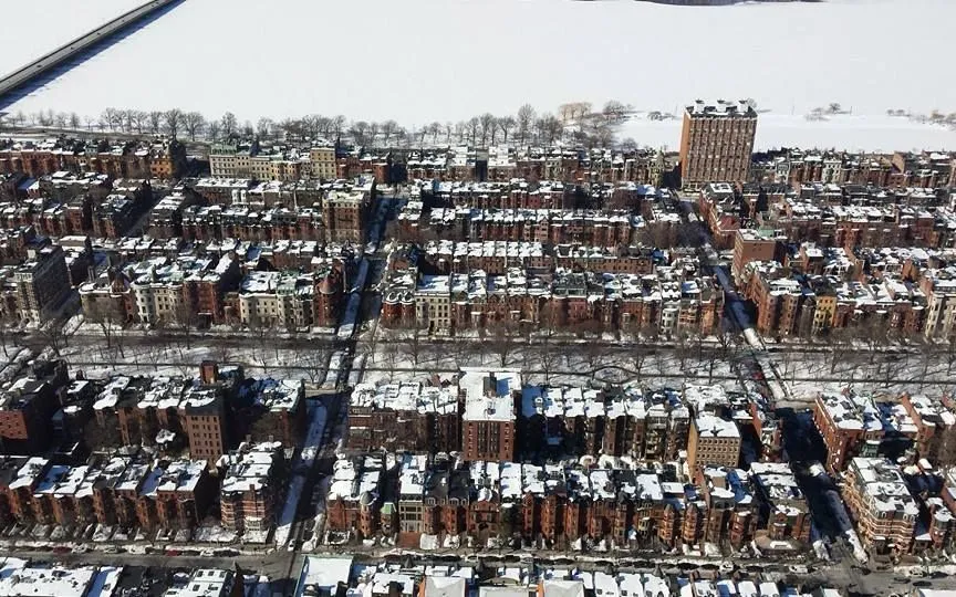
The South End holds the largest intact stretch of Victorian row houses in the country, block after block of red brick bowfronts behind iron fences. This walk starts at Union Park, the grandest of the district's garden squares, then turns up Tremont Street, where the Boston Center for the Arts fills a round brick building erected for a 400-foot Civil War painting.

From there you cross into SoWa, short for south of Washington Street. Nineteenth-century piano factories and shoe warehouses now hold galleries, artist studios, and design shops, and on Sundays from May to October the SoWa Open Market fills the old power station grounds with food and craft stalls. Give yourself about 90 minutes before the food pulls you in.

Hear it on the street

Get the turn-by-turn audio guide in the app. The narration plays itself as you reach each stop, hands-free and offline.

Stop by stop

The route

Interactive map of the route. The full stop list below works without it.

Union ParkMust see

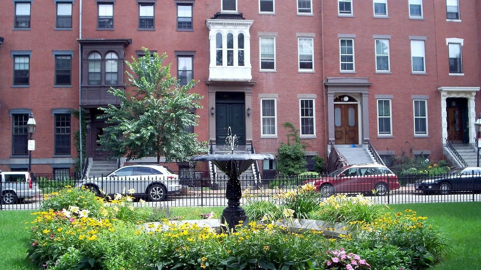
Photo by Boston Starbucks Rebel on Wikimedia Commons

Union Park

0:00

The best-preserved garden square in the South End, ringed by 1850s bowfronts behind a lotus-pattern iron fence.

You're standing at the front edge of Union Park, the best preserved of the South End's garden squares. The oval green behind its cast-iron fence was laid out in 1851 by the city engineer Ellis S. Chesbrough, and every house around it was finished by 1859. Look at the fence first. That lotus pattern is a direct copy of the one around Louisburg Square on Beacon Hill, and two matching iron fountains once anchored the lawn.

The houses tell you who this neighborhood was built for. Boston's leaders laid out Union Park, Chester Square, and Worcester Square in 1850 and 1851 to keep middle-class families from leaving for the new suburbs. The bowfronts facing you, with their Italianate brackets and a few Greek Revival touches, went up on lots sold at auction in June 1851. Number 45, finished that same year, was the first house on the block.

Numbers 20 and 22 have a quieter second act. In 1909 the architects Peabody and Stearns remodeled them for the South End House, one of the settlement houses that served the neighborhood's newer immigrant families. Walk once around the square and count the bow windows, then head for Tremont Street.
≈4 min walk to the next stop
Boston Center for the ArtsMust see

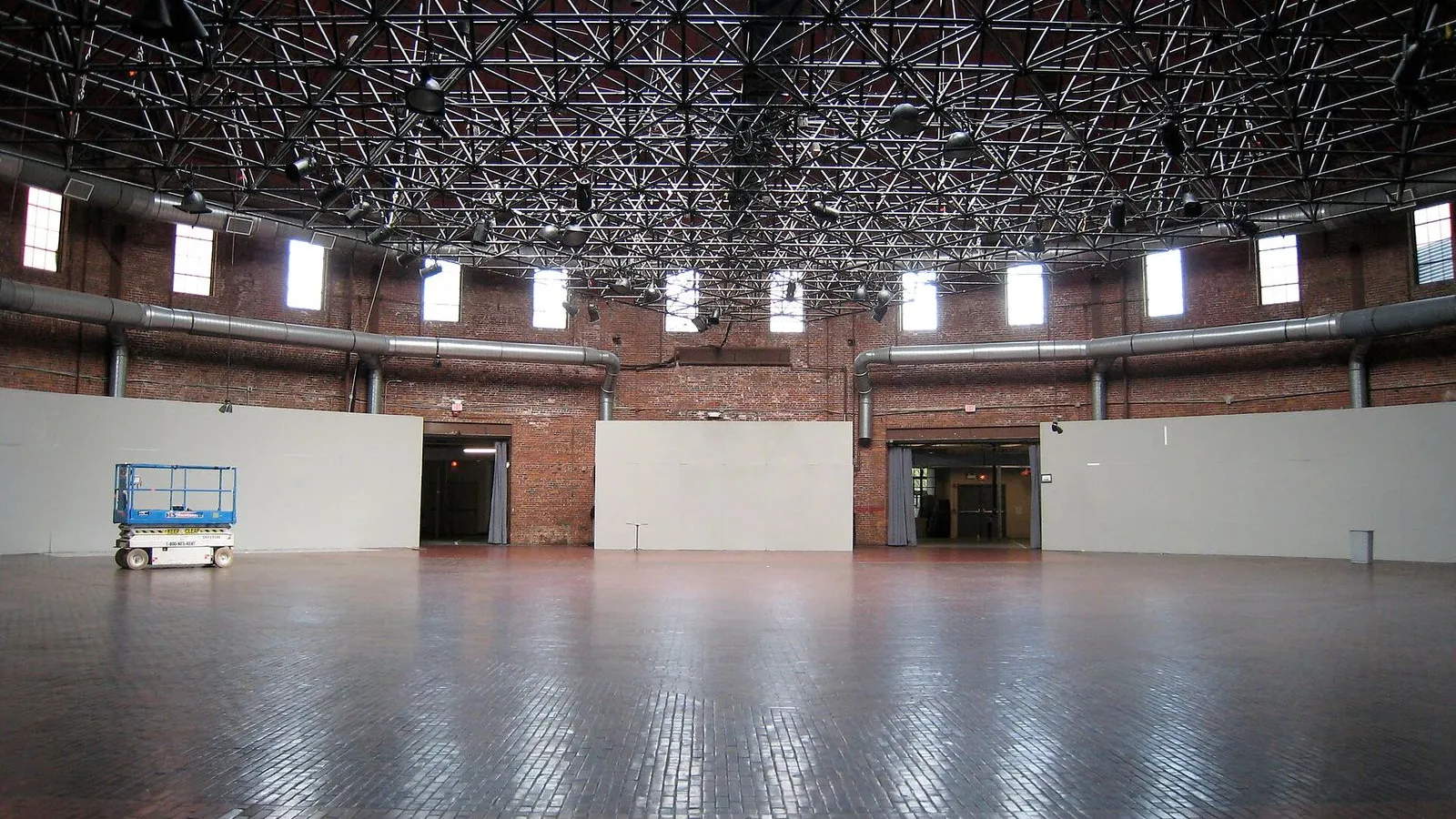
Photo by Connie from Cambridge, MA, USA on Wikimedia Commons

Boston Center for the Arts

0:00

A round brick building erected for a 400-foot Civil War panorama, now the heart of a busy arts campus.

You're facing the Cyclorama, the round brick building that anchors the Boston Center for the Arts. It went up in 1884 for one picture: The Battle of Gettysburg, a panorama by the French painter Paul Philippoteaux. The canvas ran nearly 400 feet around and 50 feet high. Visitors paid 50 cents, climbed a dark staircase, and stepped onto a platform ringed by the battle. Dirt, canteens, and cannons were set in front of the canvas to finish the illusion. The dome above you, by the architects Charles Amos Cummings and Willard T. Sears, was the largest in the country after the U.S. Capitol's.

When the craze for cycloramas faded, the building led stranger lives. John L. Sullivan boxed here in the 1890s, and later it became a bicycle rink and an auto shop, where Albert Champion invented his A.C. spark plug in 1907. The Boston Flower Exchange filled the hall in the 1920s, then left in 1971, and the building came back to art.

Inside today you may catch an exhibition or an event. The campus around it grew too: the Calderwood Pavilion opened in 2004 as Boston's first new theater in 75 years. When you are ready, head east toward Washington Street and SoWa.

≈10 min walk to the next stop
SoWa Art and Design DistrictMust see

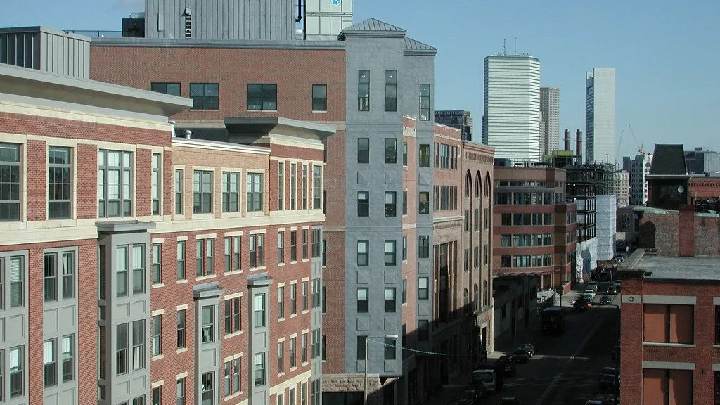
Photo by SoWa Sundays on Openverse

SoWa Art and Design District

0:00

A former factory at 450 Harrison Avenue holding more than 20 galleries and 80 artist studios.

You're at 450 Harrison Avenue, the working heart of SoWa. Behind these brick walls sit more than twenty galleries and more than eighty artist studios. In the nineteenth century this building and its neighbors made pianos, shoes, and canned goods. The heavy timber floors and tall windows that once suited machinery now give painters and printmakers the light and space they need.

The artists got here first. By the 1980s this block beyond Washington Street was run down and half vacant, known mostly for the Pine Street Inn, a homeless shelter. Artists rented the cheap lofts, and the first gallery opened in 1996. The neighborhood's name came later, in the early 2000s, when the developer Mario Nicosia shortened south of Washington to SoWa, a wink at New York's SoHo. The pedestrian walkway Thayer Street runs between this building and number 460 next door.

On the first Friday of each month the galleries stay open from five to nine and the corridors fill, and on most Sundays the studios open too. Step inside. The ground floor is galleries and design shops, the upper floors are working studios where artists will talk about what they are making. When you are done, walk a block down Harrison to the big brick power station.

≈2 min walk to the next stop
Free preview ends here · stops 4 to 4 continue in the app

SoWa Power Station

An 1891 railway power station, once the world's largest, now home to the SoWa Open Market.

in app
Good to know

Before you go

When is the SoWa Open Market open?

Sundays from May 3 to November 15, 11 am to 5 pm. It fills the old power station grounds with food and craft stalls, and the galleries and artist studios around it stay open through the week.

SourceSoWa Boston
Is the South End walk free?

Yes. Union Park and the brick streets are free to walk, and the galleries and artist studios in the SoWa district are open to browse. You pay only for what you buy or eat.

What is the Cyclorama?

A round brick building erected for a 400-foot Civil War panorama, now the center of the Boston Center for the Arts. The building itself is the landmark; shows and events rotate inside.

SourceBoston Center for the Arts

Provenance · last verified August 21, 2026

Built from the Wayside route itself: the stops, their order, and the walk between them.

Photo by Arturoramos on Wikimedia Commons · CC BY-SA 3.0

Photo by Boston Starbucks Rebel on Wikimedia Commons · Public domain

Photo by Connie from Cambridge, MA, USA on Wikimedia Commons · CC BY 2.0

Photo by SoWa Sundays on Openverse · CC BY-SA 2.0

Photo by Jimmy Woo on Unsplash

Photo by King of Hearts on Wikimedia Commons · CC BY-SA 4.0

Photo by Brett Wharton on Unsplash

Photo by Jon Platek on Wikimedia Commons · CC BY-SA 3.0

Photo by Eganjm18 on Wikimedia Commons · CC BY-SA 4.0

Photo by Matt Collamer on Unsplash

Coming soon

Wayside isn't in the app stores yet, but it's in the works. Check back soon.