Boston · Self-guided audio walk

Back Bay Grand Avenues

A 105-minute walk down Boston's grandest boulevard, from the elms of Commonwealth to the Marathon's finish and Copley Square.

  • 5Stops
  • 5.3 kmDistance
  • 75+ minTime
Back Bay Grand Avenues

Photo by Eganjm18 on Wikimedia Commons

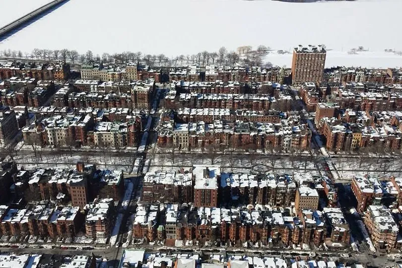
Back Bay was a tidal basin until the 1850s, when Boston filled it with gravel and laid out its grandest grid, cross streets running alphabetically from Arlington to Hereford. This walk starts on the Commonwealth Avenue Mall at Clarendon Street and follows the tree-lined mall west past its statues, then drops one block south to the brownstone shops of Newbury Street.

It finishes where two of Boston's most famous lines meet: the Marathon's blue and gold finish line on Boylston Street, and the glass of 200 Clarendon reflecting Richardson's 1877 Trinity Church across Copley Square. Allow about an hour and three quarters, with coffee on Newbury.

Hear it on the street

Get the turn-by-turn audio guide in the app. The narration plays itself as you reach each stop, hands-free and offline.

Stop by stop

The route

Interactive map of the route. The full stop list below works without it.

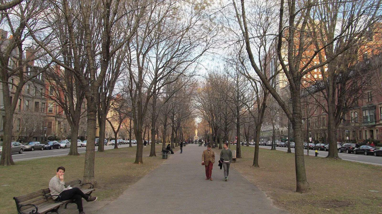
Commonwealth Avenue MallMust see

Photo by John Phelan on Wikimedia Commons

Commonwealth Avenue Mall

0:00

The tree-lined centerpiece of Back Bay's 1850s grid, a French-style mall of elms and statues running from the Public Garden west to the Fens.

You're standing on the Commonwealth Avenue Mall at Clarendon Street, and the ground beneath you is younger than almost everything around it. Until the 1850s this was a tidal basin. Boston filled it with gravel hauled in by train from Needham, and in the busiest years a train arrived every forty-five minutes and two new house lots were created each day. Arthur Gilman drew the plan in 1856, a French boulevard with a long grassy mall down its middle.

The cross streets run alphabetically from east to west: Arlington, Berkeley, Clarendon, Dartmouth, Exeter, Fairfield, Gloucester, Hereford. Winston Churchill is said to have called this avenue the grandest boulevard in North America. The first design had no statues; nine were added later, and on the block just west of you are a memorial to Mayor Patrick Collins and one to the firefighters killed in the Vendome Hotel fire. Every statue faces east toward the Public Garden.

We are going the other way. Walk west, under the trees.
≈5 min walk to the next stop
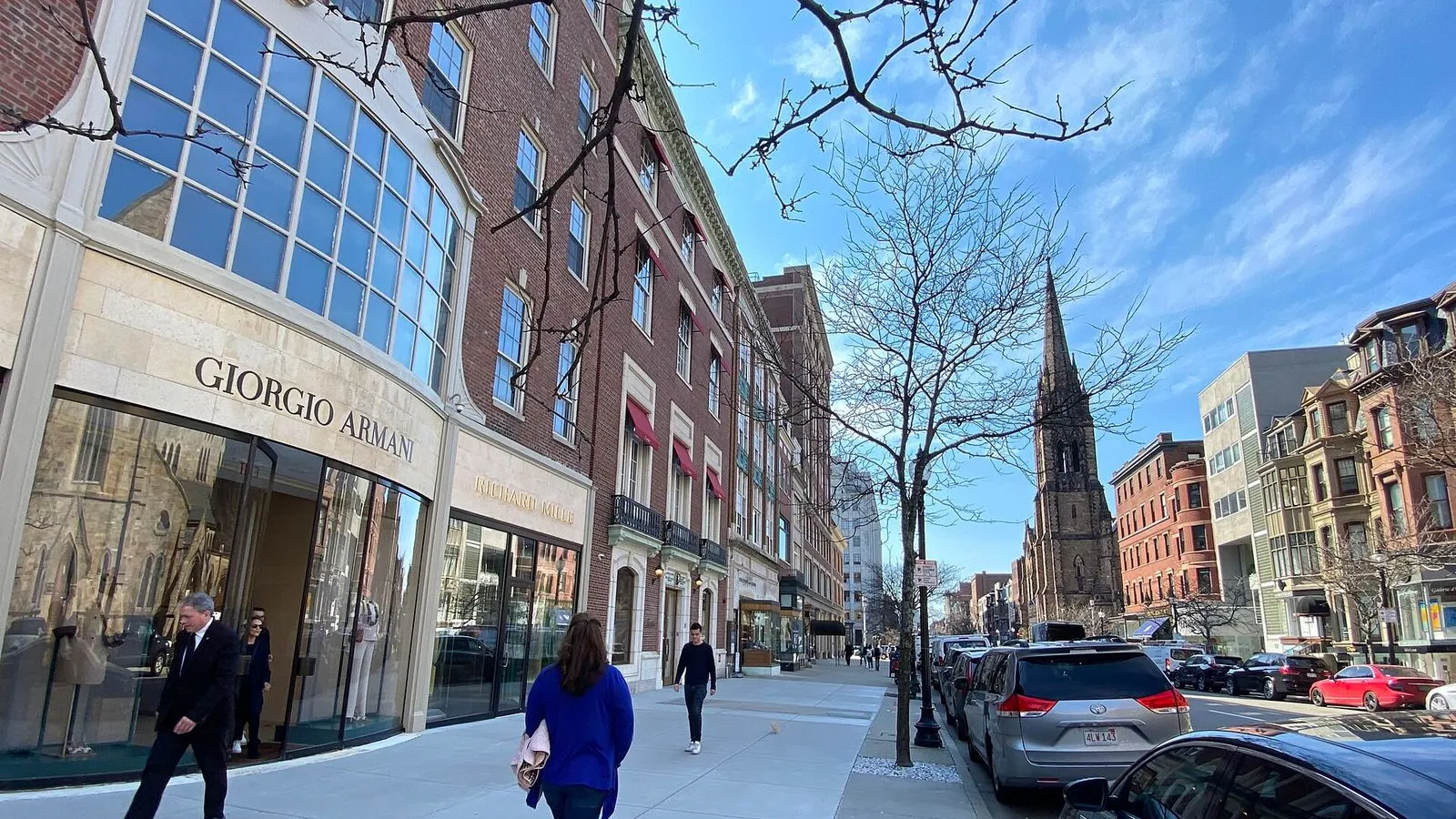
Newbury StreetLocal pick

Photo by Sharon Hahn Darlin on Wikimedia Commons

Newbury Street

0:00

A mile of 19th-century brownstones turned shopfronts, high-end at the east end and looser as it heads west.

This is Newbury Street, one block south of the mall. The name comes from a Puritan victory in the 1643 Battle of Newbury. The brownstones around you went up in the late 1800s as private houses, part of the same filling of Back Bay that made the mall you just left. Their bow fronts and little iron balconies are still here; what changed is the ground floor.

Around 1905 shopkeepers began cutting display windows into the old parlors, and by the 1920s this was where well-to-do Boston came to spend. East of Massachusetts Avenue the street stays luxury-heavy: Tiffany, Cartier, Valentino. Walk west and the labels give way to vintage shops, cafés, and bookstores, which is where the coffee part of this tour fits. Look up as you go.

The upper floors still read as a row of houses, one family to a brownstone, each with its own cornice line. Cross the street when something pulls you in. We rejoin the route on Boylston, one block south.

≈28 min walk to the next stop
Boston Marathon Finish LineMust see

Photo by Bill Morrow from Tucson, AZ, US on Wikimedia Commons

Boston Marathon Finish Line

0:00

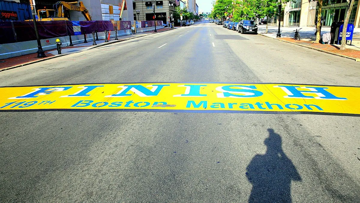
A painted blue-and-gold stripe on Boylston Street that ends the world's oldest annual marathon.

Look down. The blue and gold stripe in the pavement is the finish line of the Boston Marathon, laid in the colors of the Boston Athletic Association and refreshed every spring. You're standing between Exeter and Dartmouth Streets, in front of the Public Library, and this exact placement dates to 1985, when John Hancock became the race's main sponsor. The race is much older: it was first run on April 19, 1897, and it's the oldest annually run marathon in the world.

The distance, 26 miles 385 yards, has been the standard since 1924. On Marathon Monday each April, about 30,000 runners cross this stripe after starting in Hopkinton. Most days it's quieter than that, just paint on an ordinary street with cars rolling over it, and that's the point. There are no ropes and no gates.

You can step across the line the same way the winners do. When you've crossed, the Library's entrance waits a short walk east.

≈22 min walk to the next stop
Free preview ends here · stops 4 to 5 continue in the app

Boston Public Library

McKim's 1895 palace for the people, a Renaissance palazzo wrapped around a quiet arcaded courtyard.

in app

Trinity Church

Richardson's 1877 Romanesque masterpiece, its granite and tower mirrored in the glass of 200 Clarendon.

in app
Good to know

Before you go

Where is the Boston Marathon finish line?

On Boylston Street in front of the Boston Public Library. It is painted in blue and gold and stays there all year, so you can stand on it on any day of the year.

Is the Boston Public Library free to visit?

Yes. The Central Library in Copley Square is free, and it runs free art and architecture tours of the McKim building, including the courtyard and the murals.

SourceBoston Public Library
Can I go inside Trinity Church on this walk?

Trinity Church opens its sanctuary to visitors for quiet reflection and runs drop-in guided tours. Check the church's current schedule before you go, since services and concerts change the open hours.

SourceTrinity Church

Provenance · last verified August 20, 2026

Built from the Wayside route itself: the stops, their order, and the walk between them.

Photo by Eganjm18 on Wikimedia Commons · CC BY-SA 4.0

Photo by John Phelan on Wikimedia Commons · CC BY 4.0

Photo by Sharon Hahn Darlin on Wikimedia Commons · CC BY 2.0

Photo by Bill Morrow from Tucson, AZ, US on Wikimedia Commons · CC BY 2.0

Photo by Jimmy Woo on Unsplash

Photo by Arturoramos on Wikimedia Commons · CC BY-SA 3.0

Photo by King of Hearts on Wikimedia Commons · CC BY-SA 4.0

Photo by Brett Wharton on Unsplash

Photo by Jon Platek on Wikimedia Commons · CC BY-SA 3.0

Photo by Matt Collamer on Unsplash

Coming soon

Wayside isn't in the app stores yet, but it's in the works. Check back soon.