Nice · Self-guided audio walk

Libération: Nice's Own Market

Six mornings a week, a working quarter north of the city center fills with the best food market on the Côte d'Azur, and almost no tourists.

  • 6Stops
  • 2.2 kmDistance
  • 35+ minTime
Libération: Nice's Own Market

Photo by Patrice Semeria on Wikimedia Commons

This short walk through the Libération quarter shows Nice as it feeds itself, far from the seafront and the Promenade. You start in the thick of the Marché de la Libération, where Niçois cooks have done their shopping since the 1890s. You explore the Gare du Sud, a Belle Époque station whose iron-and-glass train shed began life as the Russian pavilion at the 1889 Paris World's Fair and now houses a food court under Gustave Eiffel's original roof. You wind through residential streets where laundry hangs from louvered shutters and the corner tabac knows every customer by name. In about 90 minutes you see a side of the city most visitors miss entirely: the one that shops, cooks, and lives here.

Hear it on the street

Get the turn-by-turn audio guide in the app. The narration plays itself as you reach each stop, hands-free and offline.

Stop by stop

The route

Interactive map of the route. The full stop list below works without it.

Marché de la LibérationMust see

Photo by Annie Spratt on Unsplash

Marché de la Libération

0:00

Nice's main food market since the 1890s. Fish, cheese, olives, socca, and produce from the Var backcountry, six mornings a week.

You are standing at the southern edge of the Marché de la Libération, the market the Niçois call La Libé. It runs six mornings a week, Tuesday through Sunday, from six until half past noon. About 120 stallholders set up across this stretch of Avenue Malausséna, around Place du Général de Gaulle, and along the side streets. Some of these families have been coming here for generations.

The market was born in the 1890s, right after the Gare du Sud opened behind you. The Train des Pignes brought farmers down from the Var plain and the backcountry with their fruit, vegetables, flowers, and cheeses. They would unload and sell straight from the platform. A market grew around the station and never left.

Walk the length of the avenue and you will pass fishmongers with glistening catches from the Mediterranean, cheese stalls with banon wrapped in chestnut leaves, olive vendors with tapenade the color of dark chocolate, and mountains of produce from the Nice hinterland: courgette flowers, ruby tomatoes, tiny artichokes the size of a child's fist. The socca carts are usually out by nine. Follow the sound of Niçois French, the rapid patter you will not hear on the Promenade. This is the city shopping for its own table.
≈1 min walk to the next stop
Place du Général de GaulleLocal pick

Photo by Metro Centric on Wikimedia Commons

Place du Général de Gaulle

0:00

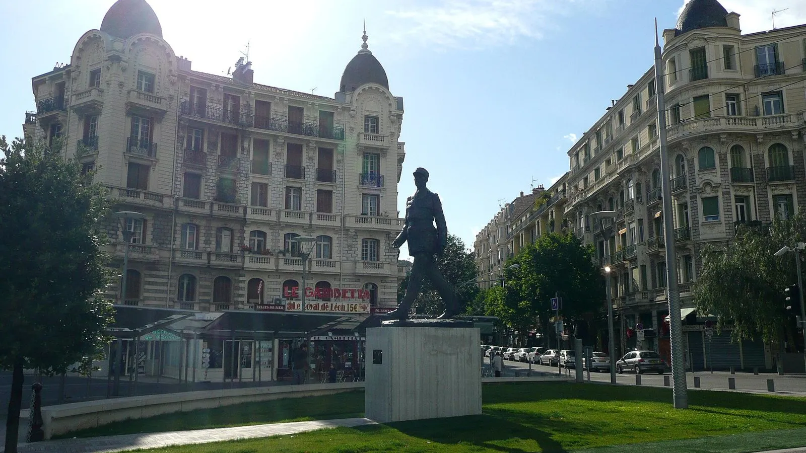
The square at the heart of the Libération quarter, where the market sprawls and where the neighborhood earned its name in August 1944.

This square wears two names. Officially it is Place du Général de Gaulle. Everyone in Nice calls it Place de la Libération. The name is not a metaphor.

On the morning of August 28, 1944, three hundred and fifty resistance fighters launched an urban guerrilla action from this neighborhood, and by the end of the day the German occupiers had withdrawn. Nice liberated itself. The Americans did not arrive until the next day. The quarter has carried the name Libération ever since.

Before the war the square was called Place Gambetta. Before that, a country chapel dedicated to Saint Étienne stood roughly where you are now, serving a rural hamlet of about a hundred people who grew watercress in the damp soil. That chapel was demolished in the late nineteenth century as the city pushed north. The Consiglio d'Ornato, the urban planning body under the House of Savoy, had laid out a grand north-south axis, today's Avenue Jean Médecin, and Avenue Malausséna extended it beyond the railway.

The square was designed as a Haussmann-style crossroads and the forecourt of the Gare du Sud. The market stalls around you are the square's oldest continuous function. Everything else changed.

≈2 min walk to the next stop
Gare du SudMust see

Photo by Kheper on Wikimedia Commons

Gare du Sud

0:00

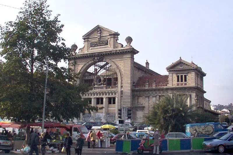
A Belle Époque railway terminus reborn as a food hall. Its iron-and-glass train shed came from the 1889 Paris World's Fair.

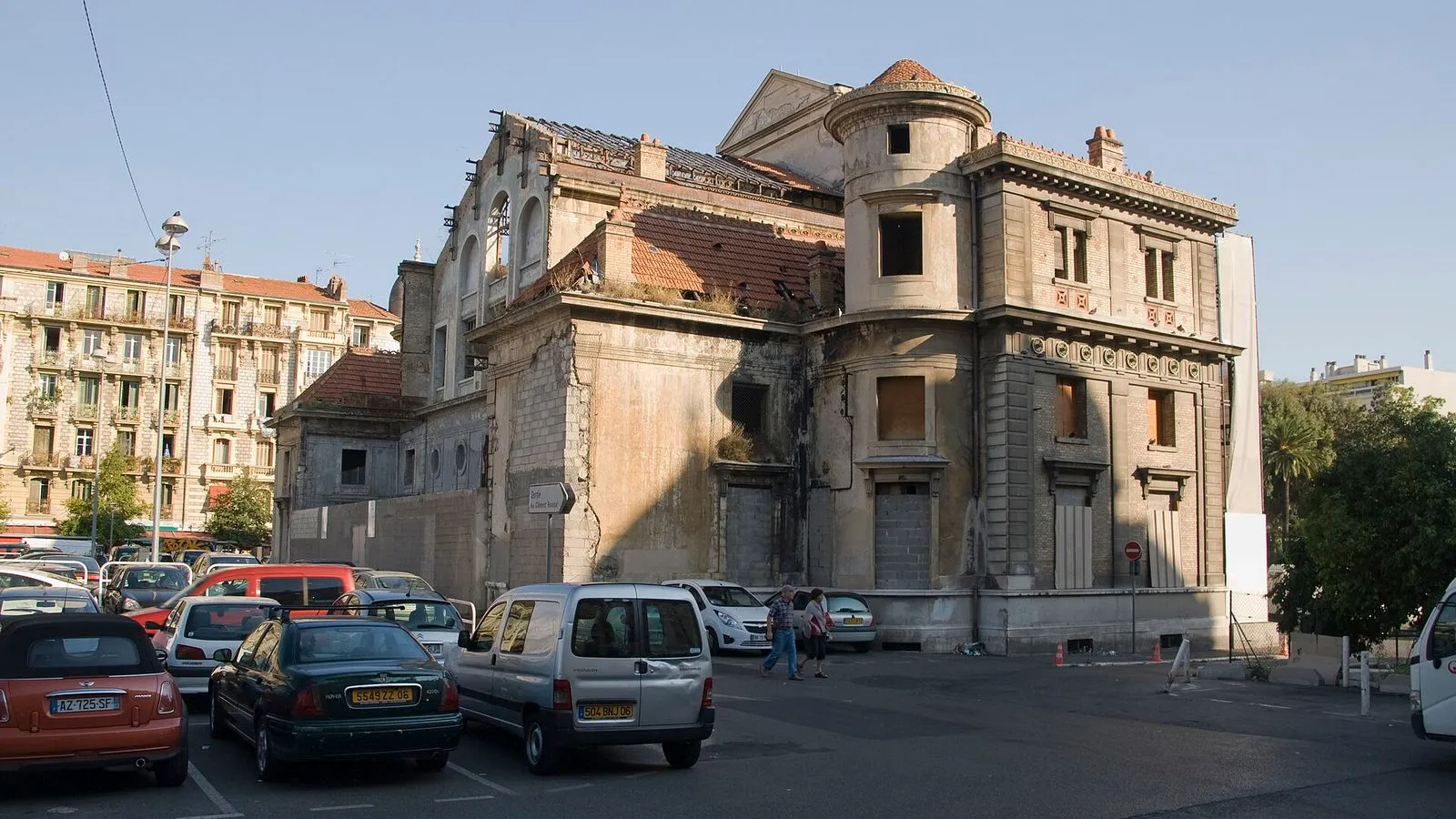
The building before you almost did not survive. When the Gare du Sud closed in December 1991 and the Train des Pignes moved to a small replacement station a few hundred meters up the line, the site sat derelict for years. Developers wanted to demolish the train shed and build apartments. In 2004 the Minister of Culture blocked the demolition.

The façade was listed as a historic monument in 2002, the metal hall in 2005. The story of this place begins in 1892, when the Compagnie des Chemins de fer du Sud de la France opened its flagship terminus. Architect Prosper Bobin, a student of Hittorff, gave it a neoclassical façade that echoed the Gare du Nord in Paris. But the real marvel is the metal train shed behind it.

That iron-and-glass structure, 23 meters wide and 18 meters high, was not built for Nice. It was the Russian and Austro-Hungarian pavilion at the 1889 Paris World's Fair. After the fair closed, the company bought it, dismantled it, and reassembled it here. Gustave Eiffel's hand is visible in every rivet.

Today the restored hall houses a food court with 28 stalls under the original glass roof. Walk inside. The marble floors are new, but the ironwork above you is the same that sheltered tsarist delegates in 1889. Step up to the mezzanine and watch the room from above.

≈6 min walk to the next stop
Free preview ends here · stops 4 to 6 continue in the app

Rue Trachel

A residential street in the grid behind the market. Belle Époque apartment blocks and everyday Niçois life, far from the seafront.

in app

Avenue Malausséna

The grand north-south avenue that anchors the quarter, laid out under Savoyard rule and still lined with market stalls every morning.

in app

Cathédrale Saint-Nicolas

The largest Russian Orthodox cathedral in Western Europe, built under Tsar Nicholas II and consecrated in 1912, with five emerald-green onion domes.

in app
Good to know

Before you go

When is the Libération market open?

The Marché de la Libération runs Tuesday to Sunday from early morning until about 13:00. It is the working food market where Niçois cooks buy their produce, fish, and cheese, and it is far less touristy than Cours Saleya. The Gare du Sud food hall next door, housed under a Gustave Eiffel iron-and-glass train shed, is open daily and stays open into the evening.

How far is Libération from the old town?

The Libération quarter sits north of the train station, outside the main tourist orbit. It is a flat, straight walk up Avenue Jean Médecin from Place Masséna, or a five-minute tram ride on line 1 to the Libération stop. Most visitors never make it this far north, which is exactly why it is worth the trip.

Provenance · last verified August 18, 2026

Built from the Wayside route itself: the stops, their order, and the walk between them.

Photo by Patrice Semeria on Wikimedia Commons · Public domain

Photo by Annie Spratt on Unsplash

Photo by Metro Centric on Wikimedia Commons · CC BY 2.0

Photo by Kheper on Wikimedia Commons · CC BY-SA 3.0

Photo by Broenberr on Wikimedia Commons · CC BY-SA 4.0

Photo by Steffen Rehfuß on Unsplash

Photo by cricketsblog on Openverse · CC BY 2.0

Photo by Leicester Holyday on Wikimedia Commons · CC BY 3.0

Coming soon

Wayside isn't in the app stores yet, but it's in the works. Check back soon.