Edinburgh · Self-guided audio walk

The Royal Mile

From castle to palace on one ridge of rock, told through the closes that drop off it: a free writers' museum, a 17th-century-style garden, and a courtyard the London coaches left from.

  • 8Stops
  • 2.2 kmDistance
  • 40+ minTime

The Royal Mile is not one street but a sequence of them along a single ridge of rock, from the Castle Esplanade through Castlehill, the Lawnmarket, the High Street and the Canongate. This walk stays on the top of that ridge, west to east, and spends its time in the closes that drop off both sides.

The stops are the ones a group tour cannot linger in: Lady Stair's Close and the free Writers' Museum, St Giles' Cathedral with the Mercat Cross and Parliament Square beside it, John Knox House at seven pounds, and the Museum of Edinburgh in Huntly House, also free, opposite the old Canongate Tolbooth and the kirk.

It finishes in two more closes, Dunbar's Close Garden and White Horse Close, before the ridge runs out at the Palace of Holyroodhouse. All of it on top of the ridge, sloping down from castle to palace.

Hear it on the street

Get the turn-by-turn audio guide in the app. The narration plays itself as you reach each stop, hands-free and offline.

Stop by stop

The route

Interactive map of the route. The full stop list below works without it.

Castle EsplanadeMust see

Photo by Olliebailie on Wikimedia Commons

Castle Esplanade

0:00

The parade ground in front of the castle, where the ridge begins.

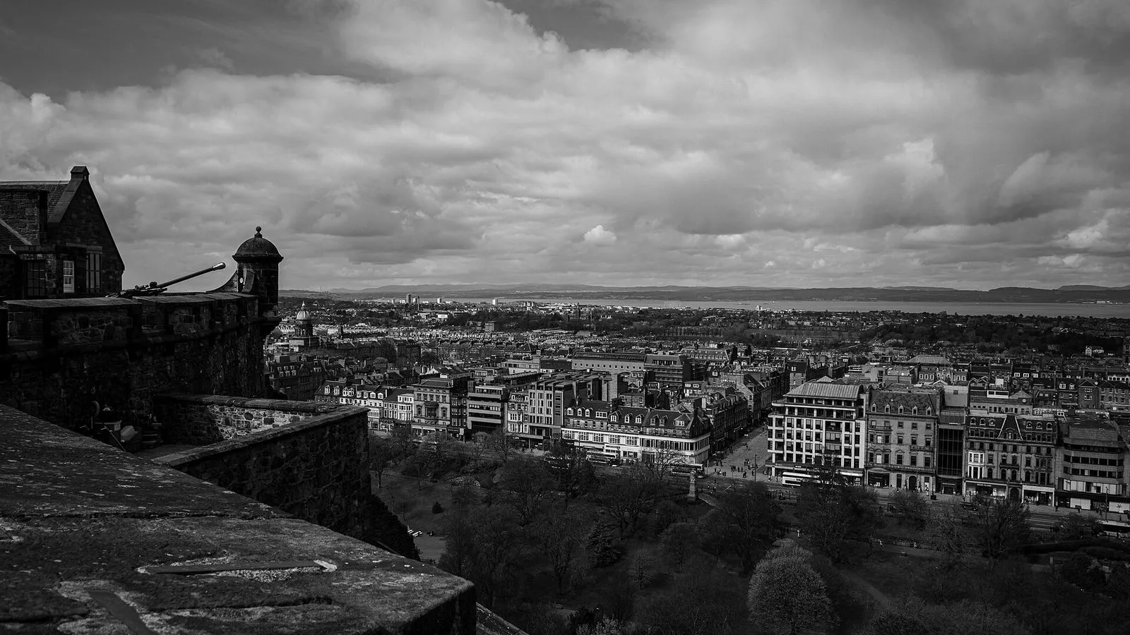
You're standing on the Esplanade, the flat apron of ground in front of the castle gates. It was laid out in 1753 as a parade ground, using spoil from the building of the Royal Exchange down the street, and widened in 1816 with the walls and railings you see now. The Military Tattoo fills it every August, and its stands occupy the Esplanade for weeks on either side of the show. Turn around and look east instead.

The whole of the Old Town is laid out in front of you on a single ridge of rock: one street along the top, falling away steeply on both sides. That shape decided everything. Edinburgh grew from two ends at once. David I founded St Giles' church on this ridge in 1124, and when he founded Holyrood Abbey at the other end he gave the abbot permission to build houses up the ridge toward it.

Castle and abbey reached for each other across the centuries, and the street between them is what you're about to walk. The closes are the other half of the story. They drop off both sides, and the town really lived down them.
≈4 min walk to the next stop
Lady Stair's CloseLocal pick

Photo by Enric on Wikimedia Commons

Lady Stair's Close

0:00

Narrow entry off the Lawnmarket, with the free Writers' Museum inside.

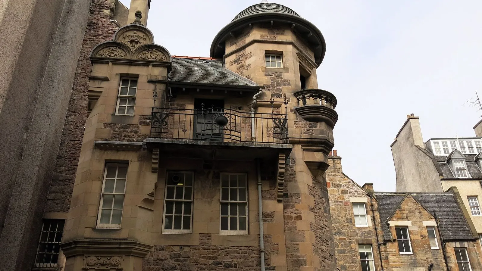
Lady Stair's Close is a good first close, because it shows you what these passages actually were. It's narrow, it's dark at the entrance, and it leads to a courtyard with a house in it. That's the pattern all the way down the ridge: a gate on the street, a private world behind it. The house went up in 1622 for Sir William Gray of Pittendrum, and it was called Lady Gray's House at first.

In 1719 it was bought by Elizabeth Dundas, Lady Stair, widow of the first Earl of Stair. She died in 1731, and her name outlived everyone else's. The Writers' Museum fills it now, and entry is free. Three writers hold the collection: Sir Walter Scott, Robert Louis Stevenson, and Robert Burns.

Burns stayed a few doors away in Baxter's Close, since demolished, on his first visit to Edinburgh in 1786. Outside in the courtyard, the paving stones of Makars' Court are carved with the names of Scottish writers. Look down at them as you leave.

≈3 min walk to the next stop
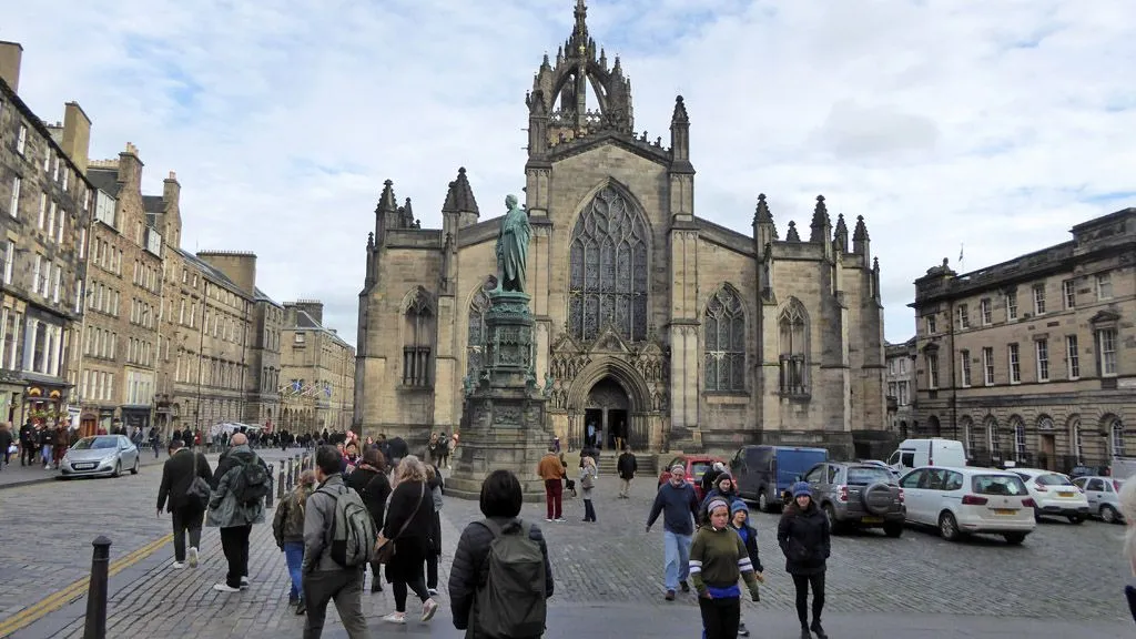
St Giles' CathedralMust see

Photo by Robin Webster on Wikimedia Commons

St Giles' Cathedral

0:00

The High Kirk, its crown spire over Parliament Square and the Mercat Cross.

St Giles' is the reason the ridge has a middle. David I founded the church here in 1124, before most of the town existed, and for the whole of the Middle Ages it was the only parish church inside the city walls. Fire gutted it in 1385 and it was rebuilt bigger, then enlarged for centuries by guilds and wealthy families. The crown steeple above you dates from around 1500 and was found ruinous and repaired under John Mylne in 1648.

The square tells the rest of it. Behind the church is Parliament Square, and in it the Mercat Cross, first mentioned in a charter of 1365. Royal and parliamentary proclamations for all of Scotland were read out from the cross, and on 18 September 1745 Charles Edward Stuart had his father proclaimed King James VIII at it. After Culloden the following year, the captured Jacobite colours were burned on the same spot.

Parliament House, the old Scottish parliament, now holds the Supreme Courts. Inside the kirk, look for the Thistle Chapel of 1910, and remember Jenny Geddes, who threw her stool at a preacher in 1637 and set off a riot.

≈6 min walk to the next stop
Free preview ends here · stops 4 to 8 continue in the app

John Knox House

A 1470 house with timber galleries, at the old Netherbow gate.

in app

Museum of Edinburgh

Huntly House, free museum of the city, opposite the old tolbooth.

in app

Dunbar's Close Garden

A 1970s garden in the manner of a 17th-century plot.

in app

White Horse Close

The quiet courtyard most visitors walk straight past.

in app

Palace of Holyroodhouse

Where the ridge ends, beside the ruined abbey.

in app
Good to know

Before you go

Do I need to book Edinburgh Castle tickets in advance?

Edinburgh Castle uses timed entry and often sells out in summer, so book online before you travel: adult admission is £23.50 online against £26.00 at the gate.

SourceHistoric Environment Scotland: Edinburgh Castle plan your visitEdinburgh Castle: tickets
Is the Royal Mile flat?

The Royal Mile runs along the top of a single ridge and slopes downhill from the Castle Esplanade to Holyroodhouse, so the main walk is gentle. The closes that drop off both sides are the steep part, and they're worth the detour.

What does this walk cost?

The Royal Mile walk itself is free, and the Writers' Museum and the Museum of Edinburgh are free to enter. John Knox House charges £7.00, and the castle and the Palace of Holyroodhouse are separately ticketed at £23.50 and £22.00 for adults online.

SourceHistoric Environment Scotland: Edinburgh Castle plan your visitRoyal Collection Trust: Palace of Holyroodhouse
Keep exploring

More walks in Edinburgh

The New TownThe hidden side

The New Town

A grid drawn in 1766 by a 26-year-old, then built street by street. Walk Edinburgh's New Town from Charlotte Square east to St Andrew Square, and finish among the monuments and gardens at its eastern edge.

8 stops2.8 km45+ min
PortobelloThe local mix

Portobello

Two miles of sand, a promenade finished in 1891 and a high street that works in February: Edinburgh's seaside, walked from the bookshop and its kilns to the rocks at Joppa.

4 stops2.1 km30+ min
Leith and the ShoreThe hidden side

Leith and the Shore

Leith ran its own affairs until 1920, and the harbour still behaves like a town of its own: a royal yacht, a nine-storey distillery, a swing bridge, and a waterfront of bars.

6 stops1.9 km30+ min
Holyrood Park and DuddingstonThe local mix

Holyrood Park and Duddingston

Skip the summit. This walk goes around Arthur's Seat instead, past two lochs and a ruined chapel, over the park's quiet side to a village with a twelfth-century kirk and one of Scotland's oldest pubs.

5 stops3.1 km45+ min
Calton HillThe hidden side

Calton Hill

A short climb from Waterloo Place through a graveyard, a free gallery in an old observatory and a Parthenon the city never finished, with the whole of Edinburgh laid out below.

4 stops0.8 km15+ min
Dean Village and the Water of LeithThe hidden side

Dean Village and the Water of Leith

A river walk from the gallery above the gorge, down past Telford's bridge of 1831 and a mill village's courtyard, to the Sunday market and the co-operative terraces of Stockbridge.

6 stops2.5 km40+ min
Grassmarket and GreyfriarsThe essentials

Grassmarket and Greyfriars

Below the castle, a market square that was also a gallows; above it, a town wall, a graveyard with a faithful dog, and a museum roof looking back over the Old Town.

6 stops1.1 km20+ min

Provenance · last verified September 26, 2026

Built from the Wayside route itself: the stops, their order, and the walk between them.

Photo by Wyatt Simpson on Unsplash

Photo by Olliebailie on Wikimedia Commons · CC BY-SA 4.0

Photo by Enric on Wikimedia Commons · CC BY-SA 4.0

Photo by Robin Webster on Wikimedia Commons · CC BY-SA 2.0

Photo by Çağlar Canbay on Unsplash

Photo by Paul Harrop on Wikimedia Commons · CC BY-SA 2.0

Photo by Stuart Hay on Unsplash

Photo by Adam Bouse on Unsplash

Photo by Connor Mollison on Unsplash

Photo by Daniel J. Schwarz on Unsplash

Photo by Kalisa66 on Wikimedia Commons · CC0

Coming soon

Wayside isn't in the app stores yet, but it's in the works. Check back soon.