Montpellier · Self-guided audio walk

The Peyrou and the Arceaux Aqueduct

Start at the market under Montpellier's double arcade of arches, then climb to the city's highest terrace, a 16th-century botanical garden, and a cathedral raised by a pope's builders.

  • 5Stops
  • 1.7 kmDistance
  • 25+ minTime
The Peyrou and the Arceaux Aqueduct

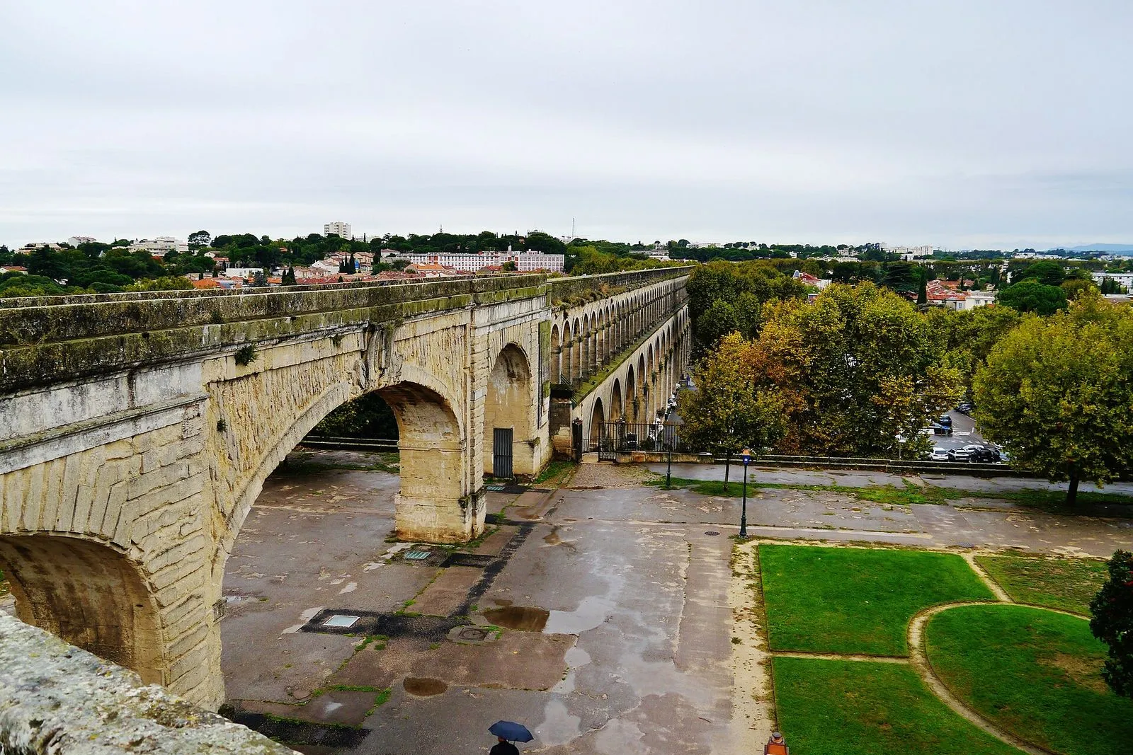
Photo by Zairon on Wikimedia Commons

This walk follows Montpellier's open western edge, where the city's water once arrived. You begin at the foot of the Saint-Clément aqueduct on boulevard des Arceaux, where a double arcade of arches shelters a farmers' market on Tuesday and Saturday mornings, with up to eighty organic growers.

The route climbs beside the arches to the hexagonal water tower, then crosses the Promenade du Peyrou, the highest ground in town at fifty-two metres, with its long view west to the hills. The Arc de Triomphe frames the terrace as a landmark underfoot; its rooftop opens only on a booked tourist-office climb.

You finish at the Jardin des Plantes, France's oldest botanical garden, founded in 1593, and the free interior of the Cathédrale Saint-Pierre, a Gothic church that became a cathedral in 1536, beside the old medical faculty. Start at the market about half past twelve on a Tuesday or Saturday: the stalls run until half past one, the garden is open by the time you reach it, and the cathedral reopens at half past two as you arrive.

Hear it on the street

Get the turn-by-turn audio guide in the app. The narration plays itself as you reach each stop, hands-free and offline.

Stop by stop

The route

Interactive map of the route. The full stop list below works without it.

Marché des ArceauxLocal pick

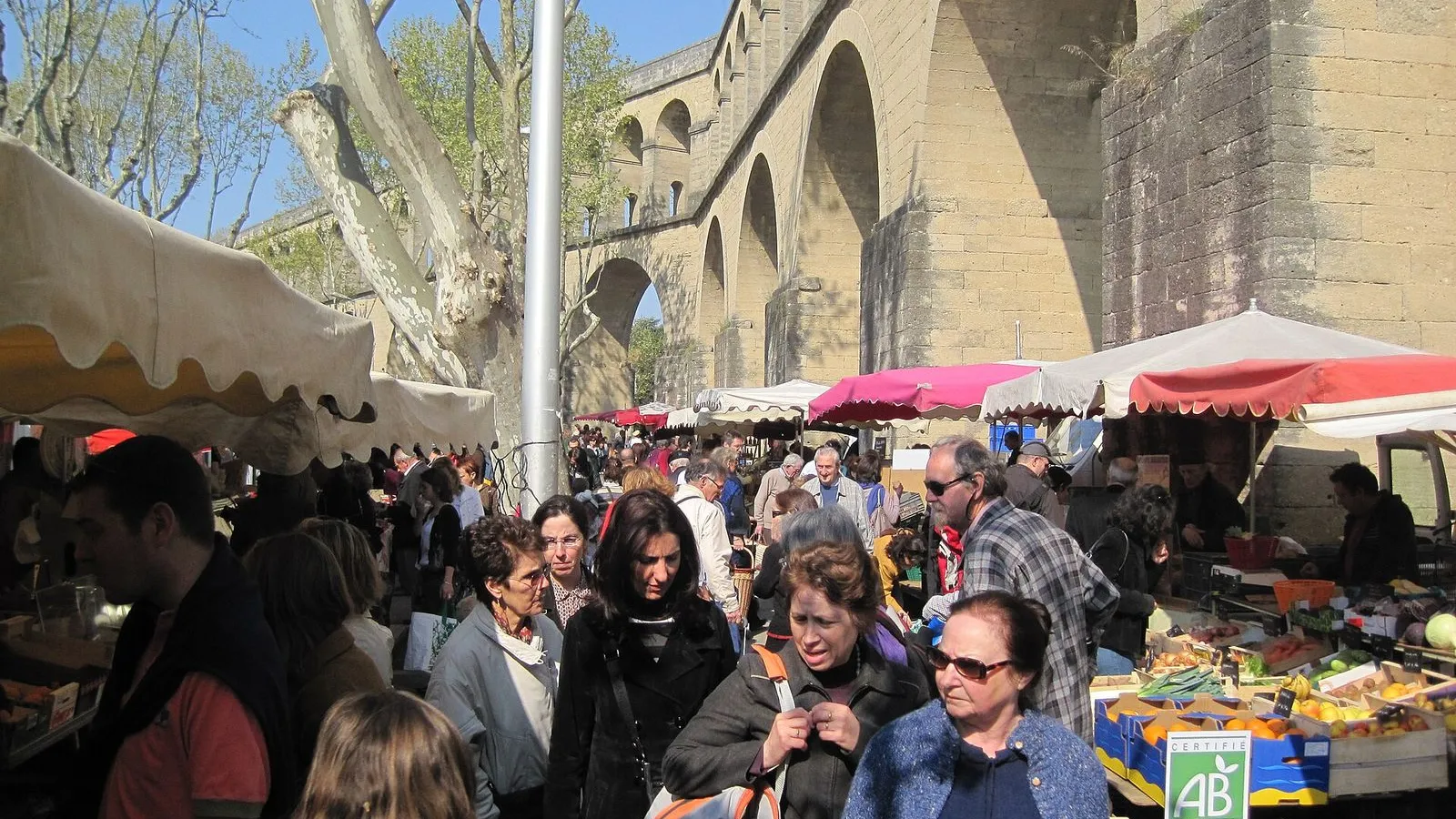
Photo by Sean Gillies on Wikimedia Commons

Marché des Arceaux

0:00

Eighty-odd organic stalls under a double arcade of stone arches.

You're at the foot of the Saint-Clément aqueduct on boulevard des Arceaux. On Tuesday and Saturday mornings, between seven and half past one, this road under the arches becomes the city's favorite food market. Up to eighty traders set out their stalls, and most of them are organic growers from the farms around Montpellier. It runs on these two mornings only, so the rest of the week this stretch of boulevard stays quiet.

The fruit, vegetables, cheese, and bread change with the season, and the light falls through the arches onto the tables. Buy your lunch here and take your time over it: the walk itself is short, and the garden and the cathedral further on both open in the early afternoon.

Look up before you move. The double arcade overhead gives the market its name and its shade, and it has sheltered this road for centuries. The water that once ran along the top finished its long climb at the highest point in the city. The arches march east from here toward the hexagonal water tower, and that climb is your route.

≈7 min walk to the next stop
Château d'Eau du PeyrouMust see

Photo by Nathan Cima on Unsplash

Château d'Eau du Peyrou

0:00

The hexagonal, Corinthian tower that ends the fourteen-kilometre aqueduct.

You're looking at the Château d'Eau du Peyrou, the hexagonal water tower that ends the Saint-Clément aqueduct. Finished in 1768, its arcaded faces carry Corinthian columns, the same temple-like language the city used for the whole royal square. Three of its six faces open through arches, and the columns turn with the corners. It is an exterior-only monument, with no public interior, so the stonework you see is the whole visit.

Behind you the aqueduct arrives. In front of you the tower once delivered its water into the city, then sent it on through the pipes below. Its reservoir was installed in 1753, fifteen years before the stonework above it was finished, and the structure has been a listed monument since 1954.

At the centre of the esplanade behind it, the equestrian statue of Louis XIV faces the tower. Together they anchor the western end of the Promenade du Peyrou. This was the endpoint the whole aqueduct was built to reach, and every drop of its water arrived here.

≈5 min walk to the next stop
Arc de TriompheMust see

Photo by Nathan Cima on Unsplash

Arc de Triomphe

0:00

The royal gateway to the city's highest promenade, built in 1691.

You're at the Arc de Triomphe, the great gate at the eastern end of the Promenade du Peyrou. It was built in 1691 and 1692 by the architect Augustin-Charles d'Aviler, on drawings by François d'Orbay, to replace a gate in the old city wall. The whole thing glorifies Louis XIV. Look for the four round medallion reliefs, carved in 1694 by Philippe Bertrand: two face the city with the Canal Royal du Languedoc and the destruction of heresy, and two face the countryside with the king's victories.

This arch is a landmark to walk under, not to climb on your own. Its rooftop opens only on a booked climb run by the tourist office: 90 steps and 5 euros, when it is offered. Without that booking, the view stays down here.

Stand under the arch and line up the axis. The esplanade, the statue, and the water tower stretch west in one straight line, the composition the city set out across its highest ground.

≈6 min walk to the next stop
Free preview ends here · stops 4 to 5 continue in the app

Jardin des Plantes

France's oldest botanical garden, laid out for a king in 1593.

in app

Cathédrale Saint-Pierre

A pope's Gothic church that became Montpellier's cathedral in 1536.

in app
Good to know

Before you go

What day should I do the Peyrou walk?

Tuesday or Saturday, when the Marché des Arceaux runs under the arches from 7 a.m. to 1:30 p.m. Avoid Monday, because the Jardin des Plantes is closed.

SourceMontpellier TourismeVille de Montpellier
Do I need to book the Arc de Triomphe rooftop?

Yes. The rooftop opens only on a tourist office guided climb of about 90 steps, and the visit costs €5 per person, so book ahead.

SourceMontpellier Tourisme
Is the Jardin des Plantes free?

Yes, entry is free. It is open Tuesday to Sunday from noon, until 8 p.m. from June to September and until 6 p.m. from October to May.

SourceVille de Montpellier

Provenance · last verified August 28, 2026

Built from the Wayside route itself: the stops, their order, and the walk between them.

Photo by Zairon on Wikimedia Commons · CC BY-SA 4.0

Photo by Sean Gillies on Wikimedia Commons · CC BY-SA 2.0

Photo by Nathan Cima on Unsplash

Photo by Nathan Cima on Unsplash

Photo by Gerd Eichmann on Wikimedia Commons · CC BY-SA 4.0

Photo by GFreihalter on Wikimedia Commons · CC BY-SA 4.0

Coming soon

Wayside isn't in the app stores yet, but it's in the works. Check back soon.