Toulouse · Self-guided audio walk

Saint-Cyprien and the Left Bank

Cross the Pont Neuf into the local half of Toulouse, where a pink-brick skyline, a photography gallery in an old water tower, and riverside meadows tell the left bank's story.

  • 8Stops
  • 2.7 kmDistance
  • 45+ minTime
Saint-Cyprien and the Left Bank

Photo by c gom on Unsplash

This walk crosses the Pont Neuf and stays on the left bank, the half of Toulouse that faces the city's own pink-brick skyline. Saint-Cyprien grew up with its feet in the Garonne, home to tanners, dyers, boatmen and, later, hospitals and slaughterhouses. Today it is the artier, more local quarter, the one the tourist office frames as the neighborhood not to miss.

You follow the river from an 1823 water tower that became France's first public photography gallery, past a medieval pilgrim hospital, to the turquoise dome of La Grave. Then the route turns inland to a slaughterhouse that is now a modern art museum, a covered market that still works as a market, and the big riverside meadow called the Prairie des Filtres.

It is a loop that ends back at the water, where the meadow's name still records how the city once filtered its drinking supply.

Hear it on the street

Get the turn-by-turn audio guide in the app. The narration plays itself as you reach each stop, hands-free and offline.

Stop by stop

The route

Interactive map of the route. The full stop list below works without it.

Pont NeufMust see

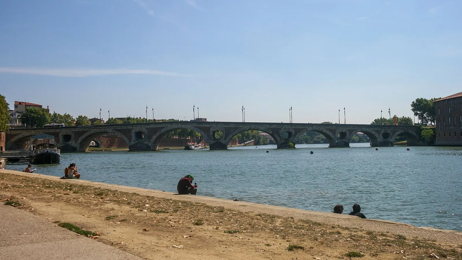
Photo by Mike Peel on Wikimedia Commons

Pont Neuf

0:00

The old pink-brick bridge that opens the left bank.

You're standing on the Pont Neuf, which is not new at all. The name is a joke that hardened into brick: this is the oldest bridge in Toulouse, and for a long time it was the only stone crossing of the Garonne. Look at the brick. It is the same pink brick that gives the city its color.

Every arch was built to hold the river in spate, and the pointed cutwaters below still split the current the way the masons intended. From here the city shows you its two halves. On the right bank is the official Toulouse of the Capitole and the cathedrals. The left bank, where you are headed, was the low shore that flooded every few years, the side where the city put its work: tanners, dyers, boatmen, and later its hospitals and slaughterhouses.

That is the Toulouse you are about to walk through, the half that faces back across the water at its own skyline.
≈3 min walk to the next stop
Le Château d'EauLocal pick

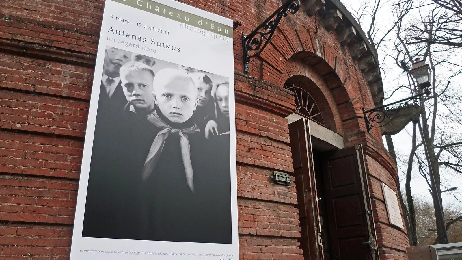
Photo by Olybrius on Wikimedia Commons

Le Château d'Eau

0:00

An 1823 water tower turned photography gallery.

This brick tower is the Château d'Eau, and its name is literal: a water tower. The first stone was laid on 27 July 1823, paid for by a bequest from Charles Laganne, a capitoul of the city. A paddle wheel in its base pumped water from the Garonne, already filtered through the gravel of the meadow where you will end the walk, and pushed it into the fountains of both banks. By 1828 the whole network was in place, but success killed it: demand quickly outgrew the tower, and it fell out of use in 1870.

It sat as a store until the photographer Jean Dieuzaide was given the building in 1971. In 1974 he opened France's first public photography gallery here, and hung the first show himself, sixty prints by Robert Doisneau. Around 500 artists have shown here since. It is open Wednesday to Sunday, from 11 in the morning to 6 in the evening, and costs 5 euros.

Go in if you can. If not, the tower still says the same thing it always did: this is where the city's water entered the left bank.

≈2 min walk to the next stop
Hôtel-Dieu Saint-JacquesLocal pick

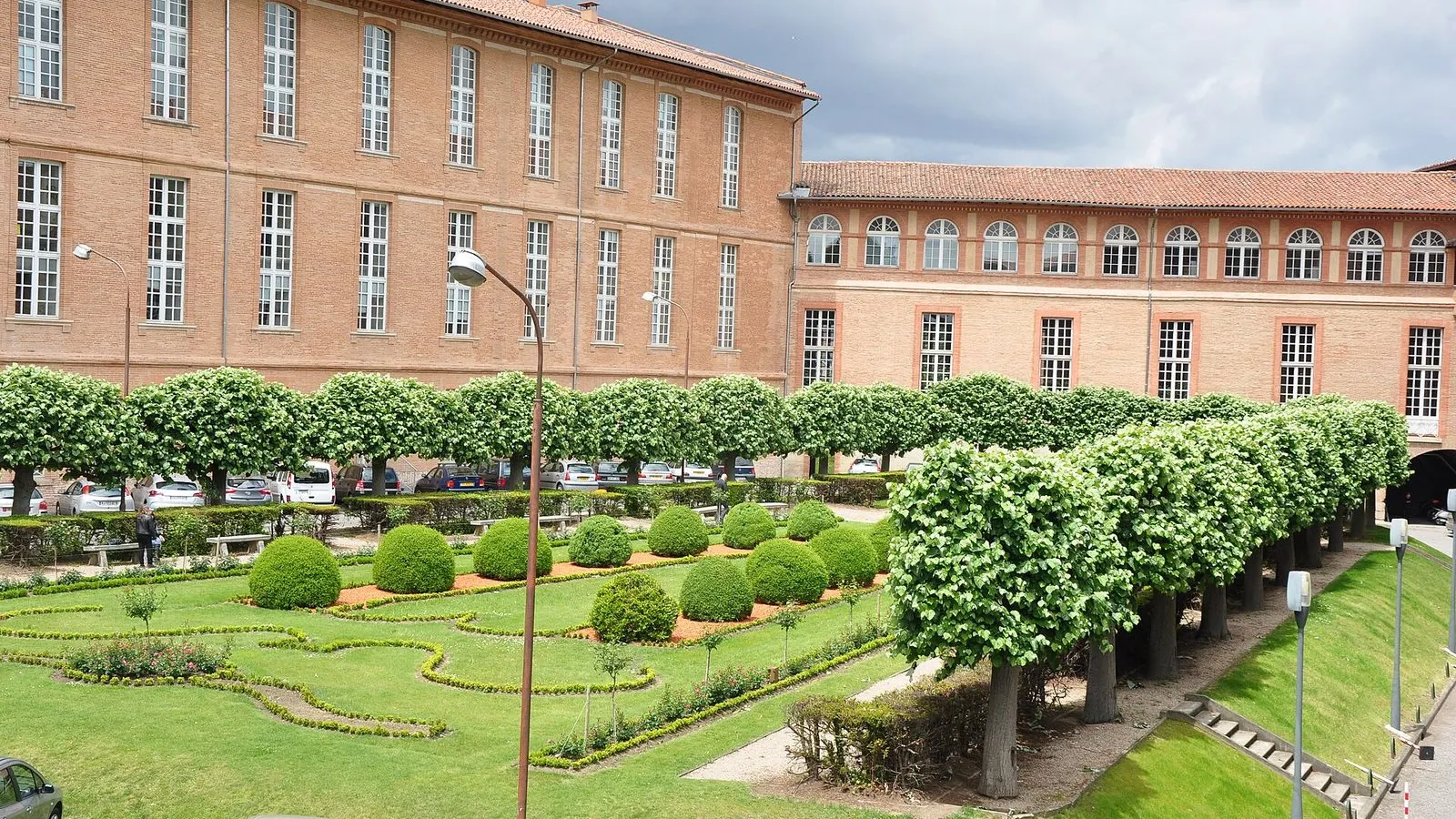
Photo by M.Strīķis on Wikimedia Commons

Hôtel-Dieu Saint-Jacques

0:00

A medieval pilgrim hospital above the Garonne.

This long brick facade is the Hôtel-Dieu Saint-Jacques, a hospital that has worked on this bank since about 1130. It began as a Benedictine foundation for pilgrims on the road to Santiago de Compostela, and in 1998 UNESCO listed it with the pilgrimage routes, one of two Toulouse sites chosen, the other being Saint-Sernin. For centuries it fed and treated the sick, the poor and the newborns left in the turnstile by the door, the tour, which you can still see to the right of the pedimented entrance. The last patients left in 1987, and the building now holds the university hospital's administration, so the old wards are not open to walk through.

The one public door is the Museum of the History of Medicine at the entrance: free, open Thursday, Friday and Sunday, from eleven in the morning until late afternoon. Before you go, look up at the large stone scallop shell over the entrance. A pilgrim passing here eight hundred years ago would have known it at once.

≈1 min walk to the next stop
Free preview ends here · stops 4 to 8 continue in the app

Port Viguerie

The belvedere with the best brick-city view.

in app

Hôpital de La Grave

The hospital dome that crowns the left bank.

in app

Les Abattoirs

A 19th-century slaughterhouse reborn as modern art.

in app

Marché Saint-Cyprien

Toulouse's last original covered market.

in app

Prairie des Filtres

The riverside meadow that once filtered city water.

in app
Good to know

Before you go

Which left bank museums are free with the Pass Tourisme?

Les Abattoirs is free with the Pass Tourisme; at the door it costs €8, with reduced rates at €6 and €5. The Château d'Eau is free for everyone on the first Sunday of the month for its permanent collection, and normally costs €5 full or €3 reduced. The other left bank stops, the Pont Neuf, the Hôtel-Dieu Saint-Jacques, Port Viguerie and La Grave, are free to see from the riverside.

SourceToulouse Tourisme: Pass TourismePass Tourisme: savings calculator
When should I do this walk?

Afternoon, and ideally not Monday or Tuesday. Le Château d'Eau opens Wednesday to Sunday from 11am to 6pm, with the ticket desk closing at 5:30pm, and Les Abattoirs opens Wednesday to Friday from noon to 6pm and Saturday and Sunday from 10am to 6pm. Both close on Monday and Tuesday. Save this walk for a day when they are open, and end at the Prairie des Filtres as the day cools, with the brick skyline across the Garonne.

Provenance · last verified August 27, 2026

Built from the Wayside route itself: the stops, their order, and the walk between them.

Photo by c gom on Unsplash

Photo by Mike Peel on Wikimedia Commons · CC BY-SA 4.0

Photo by Olybrius on Wikimedia Commons · CC BY-SA 3.0

Photo by M.Strīķis on Wikimedia Commons · CC BY-SA 3.0

Photo by Pistolero on Wikimedia Commons · CC BY 3.0

Photo by Nick Castelli on Unsplash

Photo by M.Strīķis on Wikimedia Commons · CC BY-SA 3.0

Photo by Didier Descouens on Wikimedia Commons · CC BY-SA 4.0

Photo by FrDr on Wikimedia Commons · CC BY-SA 4.0

Coming soon

Wayside isn't in the app stores yet, but it's in the works. Check back soon.