Los Angeles · Self-guided audio walk

Santa Monica: Pier, Bluffs, and Promenade

The Pacific at your feet, a 1922 carousel above the waves, and a bluff-top walk that shows why this city guards its coast so carefully.

  • 5Stops
  • 2.2 kmDistance
  • 35+ minTime
Santa Monica: Pier, Bluffs, and Promenade

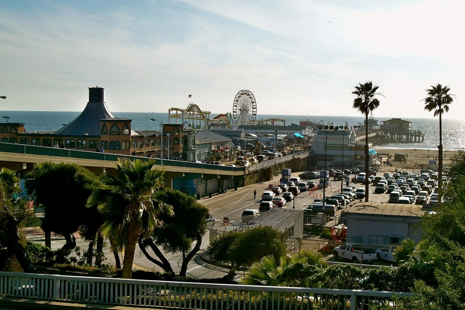
Photo by atgorden on Wikimedia Commons

Santa Monica does the oceanfront walk better than anywhere else in LA. This tour starts on the wooden planks of the 1909 Municipal Pier, a sewage project that accidentally became the city's front porch. From there, you trace the bluffs of Palisades Park, a ribbon of grass and palms the founders protected from developers back in the 1890s. A 19th-century camera obscura projects the coastline onto a table inside a darkened room, the same simple magic that drew visitors when the device sat on the beach in 1898. The walk ends in the bustle of Third Street Promenade, three car-free blocks where the city shops, eats, and lingers.

Hear it on the street

Get the turn-by-turn audio guide in the app. The narration plays itself as you reach each stop, hands-free and offline.

Stop by stop

The route

Interactive map of the route. The full stop list below works without it.

Santa Monica PierMust see

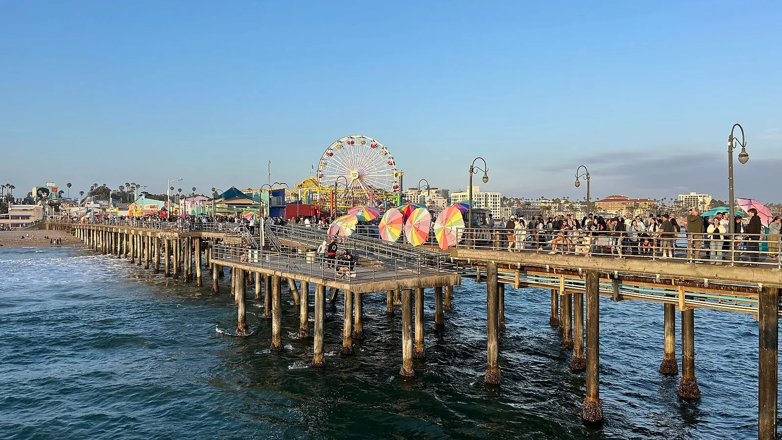
Photo by Busition on Wikimedia Commons

Santa Monica Pier

0:00

The 1909 Municipal Pier was built to carry a sewer pipe past the breakers. A pleasure pier bolted on seven years later turned it into the city's front porch.

You're standing at the foot of a pier that was never meant to be a destination. In 1909, Santa Monica had a sewage problem. The city's solution: build a 1,600-foot concrete pier with an 18-inch pipe running the whole length, so treated waste could be dumped past the breakers. That's why the Municipal Pier exists.

The pleasure part came later. In 1916, a carousel builder named Charles Looff bolted a second pier onto the south side and filled it with rides, a ballroom, and a roller coaster. The two piers have been joined ever since, and the concrete sewer pipe still runs underneath your feet. Walk out toward the water and you'll find the Looff Hippodrome, the white building with the onion dome about halfway down on your right.
≈6 min walk to the next stop
Looff HippodromeMust see

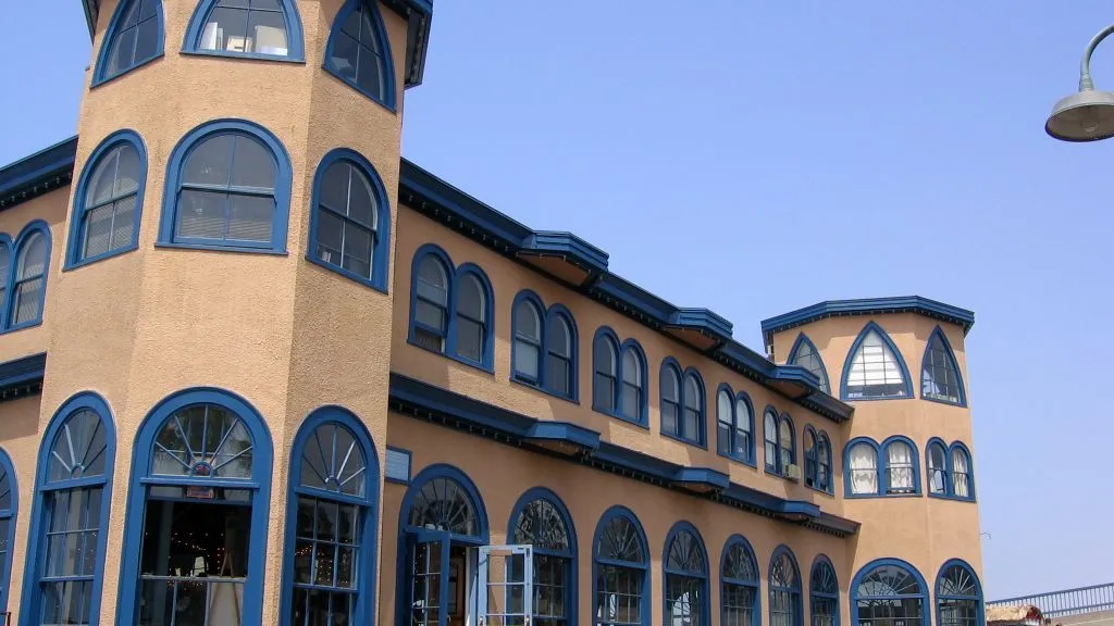
Photo by Richard Wang on Wikimedia Commons

Looff Hippodrome

0:00

A 1916 carousel house with a tent-like roof and an onion dome. Inside, 44 hand-carved wooden horses have circled since 1947, the last intact piece of Looff's amusement pier.

This is the Looff Hippodrome, a carousel house from 1916 and the last intact piece of the amusement pier Charles Looff built here. The carousel inside is a Philadelphia Toboggan Company model from 1922, number 62, with 44 hand-carved wooden horses. It was moved here from Nashville in 1947, replacing the original Looff carousel that had been sold off years earlier. Paul Newman rode one of these horses in the movie The Sting.

Look up. The octagonal towers at the corners held restrooms and concessions. The tent-like roof and onion dome make the building feel like it drifted in from a Russian fairground. If the carousel is running, step inside.

The calliope music and the creak of those wooden horses are the same sounds a rider heard here in 1947, and not much different from 1916.

≈8 min walk to the next stop
Palisades Park BluffLocal pick

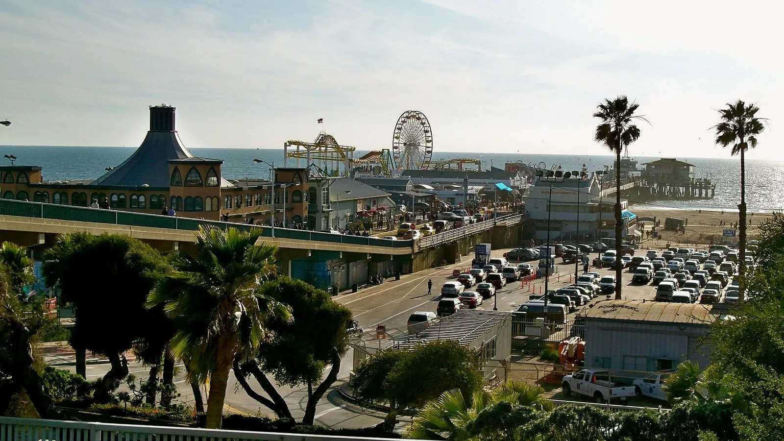
Photo by atgorden on Wikimedia Commons

Palisades Park Bluff

0:00

A mile and a half of bluff-top green that exists because the founders wrote a deed restriction forbidding buildings here in 1892. On a clear day, Malibu and Catalina fill the horizon.

You're standing at the southern end of Palisades Park, on the bluff directly above the pier you just left. Look down. From here, the pier stretches into the Pacific like a wooden finger, the Ferris wheel and the Hippodrome's onion dome small enough to pinch between your thumb and forefinger. This park runs for a mile and a half from Colorado Avenue all the way to the northern city limit, and it exists because of a deed restriction.

In 1892, the city founders John Percival Jones and Arcadia Bandini de Baker gave this land to Santa Monica with one condition: no buildings. Developers had already begun buying up oceanfront parcels, and Jones and Bandini knew what was coming. The restriction has held for more than 130 years. On a clear day you can see Malibu to the north and Catalina Island to the southwest.

The tall palm rows, the eucalyptus, the wide lawns: all of it sits on land that could have been condominiums. Walk south along the bluff path. In a few minutes you'll reach the Camera Obscura building, tucked in next to the old Senior Recreation Center.

≈3 min walk to the next stop
Free preview ends here · stops 4 to 5 continue in the app

Camera Obscura

A 126-year-old pinhole camera in a dark room above the park, projecting a live image of the coastline onto a table. It cost ten cents a view in 1898; today it's free.

in app

Third Street Promenade

Three car-free blocks of shopping, dining, and street life that were nearly lost to suburban malls. The six topiary dinosaurs have stood watch since 1989.

in app
Good to know

Before you go

Is the Santa Monica Pier free?

Yes, the pier itself is free and open to the public. Walking out to the end, watching the fishermen, and taking in the view costs nothing. Pacific Park, the amusement area on the pier, charges per ride or sells wristbands for unlimited rides. The carousel inside the Looff Hippodrome is $2 per ride.

What time is sunset at the Santa Monica Pier?

Sunset times in Los Angeles range from about 4:45 p.m. in late December to nearly 8:10 p.m. in late June. The pier faces southwest, so the sun sets over the Pacific to the right of the pier. Arrive 30 to 45 minutes before sunset for the best light on the coastline and the mountains.

Is the Camera Obscura really free?

Yes, the Camera Obscura in the Senior Recreation Center above Palisades Park is free. It is open on weekdays during center hours, typically Monday through Friday from 9 a.m. to 4 p.m. On weekends, access may be limited. Call ahead to confirm. The device projects a live image of the coastline onto a concave table inside a darkened room, just as it has since 1898.

Provenance · last verified August 18, 2026

Built from the Wayside route itself: the stops, their order, and the walk between them.

Photo by atgorden on Wikimedia Commons · CC BY 3.0

Photo by Busition on Wikimedia Commons · CC BY 4.0

Photo by Richard Wang on Wikimedia Commons · CC BY-SA 3.0

Photo by Américo Toledano on Wikimedia Commons · CC BY-SA 4.0

Photo by Mundanemetal on Wikimedia Commons · CC BY 4.0

Photo by Alfred Twu on Wikimedia Commons · CC0

Photo by Carol M. Highsmith on Wikimedia Commons · Public domain

Coming soon

Wayside isn't in the app stores yet, but it's in the works. Check back soon.