Inverness · Self-guided audio walk

Caledonian Canal to Clachnaharry

A flat towpath walk out of Inverness along the Caledonian Canal, past four locks at Muirtown to the sea lock at Clachnaharry, where an old coaching inn looks over the Beauly Firth towards Ben Wyvis.

  • 5Stops
  • 4.7 kmDistance
  • 65+ minTime
Caledonian Canal to Clachnaharry

Photo by DS Pugh on Wikimedia Commons

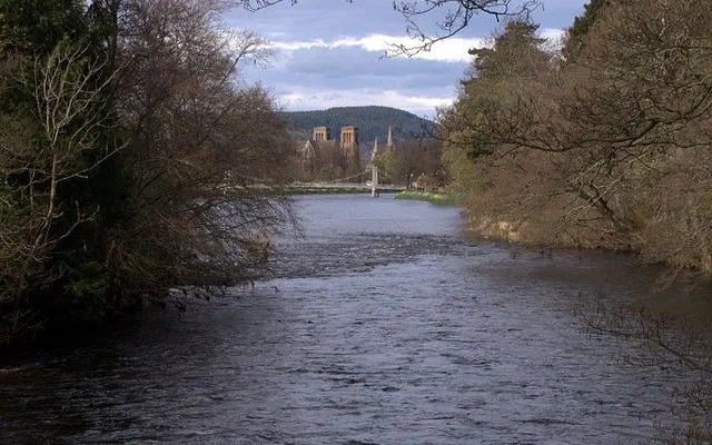
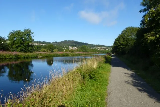
The Caledonian Canal is the working side of Inverness. This flat, one-way towpath walk follows it north-west from the swing bridge at Tomnahurich to Clachnaharry, two miles from the city centre, where the water lets boats out into the Beauly Firth.

On the way you pass the cemetery of 1864 on its wooded hill above the canal, come down the flight of four locks at Muirtown, and cross the basin that Thomas Telford planned as a second harbour for the city, built for ships that soon outgrew it.

The walk ends at a coaching inn in the old fishing village, where the patio faces the firth and Ben Wyvis. To get back, you can cross the lock gates to the far bank and follow the towpath into town.

Hear it on the street

Get the turn-by-turn audio guide in the app. The narration plays itself as you reach each stop, hands-free and offline.

Stop by stop

The route

Interactive map of the route. The full stop list below works without it.

Tomnahurich Swing BridgeLocal pick

Photo by Jim Barton on Wikimedia Commons

Tomnahurich Swing Bridge

0:00

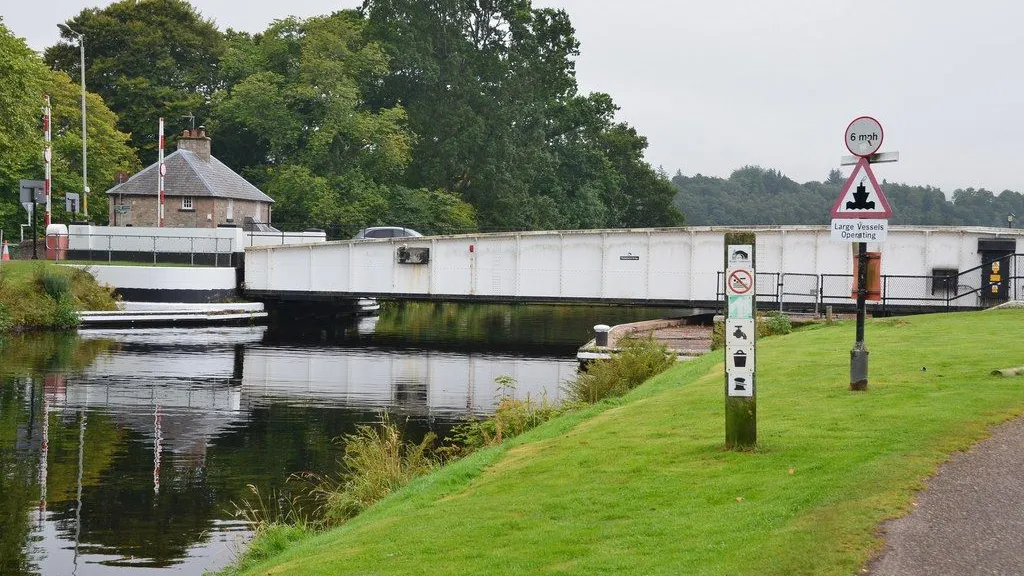
The canal's swing bridge, with the 1864 cemetery on its wooded hill.

You're standing on a swing bridge that carries the A82 over the Caledonian Canal, and this canal explains most of what you'll pass on the way out to the firth. Parliament authorised it in 1803, Thomas Telford engineered it, and it opened in 1822 to carry sea-going ships across Scotland. From here the water runs 60 miles to Corpach, near Fort William, though only 22 miles of it were dug by hand.

The wooded hill above the canal is Tomnahurich, hill of the yew wood. For centuries a horse race went round its foot every 24 and 25 May. Trees went in around 1753, and the cemetery on its slopes and summit opened in 1864, with a drive that climbs in terraces to the plateau on top. From up there you get the town, the Ness valley and the firth in one look.

The bridge itself went up in 1938 in place of an earlier swing bridge, and the keeper's house beside the road went up in 1813. It still swings open when a boat needs the channel.
≈30 min walk to the next stop
Muirtown LocksLocal pick

Photo by Dr Neil Clifton on Wikimedia Commons

Muirtown Locks

0:00

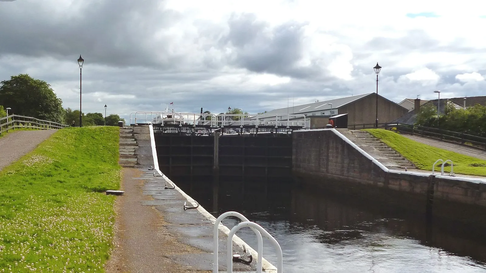
Four locks in one flight, stepping the canal down towards the firth.

This is where the canal starts its drop towards the sea. Four locks in one flight step boats down towards the firth, and the towpath runs beside all four chambers, so you can follow the whole drop on foot. Each chamber is 180 feet long and 40 feet wide, and the contractors Simpson and Cargill built them between 1808 and 1813. At the time they were the largest locks put up in Britain, because the canal was meant to take sea-going ships, frigates included.

The gates have been renewed more than once: oak and steel replacements went in between 1890 and 1906, and the flight was mechanised in 1963. In the spring of 2004 the chambers were emptied for repairs, and the bare stone floors lay open for months.

At the foot of the flight, the Muirtown swing bridge carries the road across the water and swings back whenever a boat needs the channel. Above the top gate the water runs level towards Loch Ness; below the bottom one it runs on into the basin, and two more locks at Clachnaharry take it the rest of the way down to the tide.

≈9 min walk to the next stop
Muirtown BasinLocal pick

Photo by Dr Neil Clifton on Wikimedia Commons

Muirtown Basin

0:00

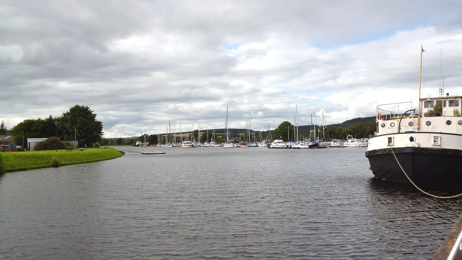
Telford's second harbour for Inverness, now a quiet marina.

This long stretch of water is Muirtown Basin, planned by Thomas Telford as a second harbour for Inverness. The digging was nearly finished by 1807, well before the canal opened. Ships too big to work up the estuary to the town quays could load and unload here instead, and plenty did. Trade shifted to Muirtown so readily that Inverness repaired its own Citadel Quay and built a new one at Thornbush in the 1810s to win the shipping back.

The basin never held the traffic it was designed for. Iron hulls and steam engines made ships longer and deeper, and the harbour stayed quiet. Now the moorings hold yachts and cruisers tied up along its edges, and the water sits flat under the west end of the town. It's the clearest reminder on this walk that the canal was built to carry freight, and that the freight found other roads.

≈15 min walk to the next stop
Free preview ends here · stops 4 to 5 continue in the app

Clachnaharry Sea Lock

Where the canal ends and boats drop into the Beauly Firth.

in app

Clachnaharry Inn

Coaching inn with horse rings in the wall and the firth outside.

in app
Good to know

Before you go

How do I get back to the city from Clachnaharry?

Getting back from Clachnaharry gives you a choice: cross the lock gates to the far bank and follow the towpath back into town, take a bus from the Beauly road past the village, or call a taxi.

SourceThe Clachnaharry Inn
Is the canal towpath easy walking?

The canal towpath is flat and level the whole way, and the route is one way out with the option of returning on the far bank. Take care at the Muirtown locks and the sea lock gates, where the path crosses stonework and lock gear. The Clachnaharry Inn at the end is the place to shelter if the weather turns.

SourceThe Clachnaharry Inn
When is the best time to walk the canal?

The canal walk is at its best on a long summer evening, when the light holds out to the end of the route and the firth sits bright behind the sea lock. In winter, walk it earlier in the day and let the inn be the finish of the walk rather than a late dinner stop, or save the towpath for a brighter trip.

SourceThe Clachnaharry Inn

Provenance · last verified September 27, 2026

Built from the Wayside route itself: the stops, their order, and the walk between them.

Photo by DS Pugh on Wikimedia Commons · CC BY-SA 2.0

Photo by Jim Barton on Wikimedia Commons · CC BY-SA 2.0

Photo by Dr Neil Clifton on Wikimedia Commons · CC BY-SA 2.0

Photo by Dr Neil Clifton on Wikimedia Commons · CC BY-SA 2.0

Photo by Stefano Bucciarelli on Unsplash

Photo by Mike Pennington on Wikimedia Commons · CC BY-SA 2.0

Coming soon

Wayside isn't in the app stores yet, but it's in the works. Check back soon.